NavVis technology vs traditional topographic surveying workflows
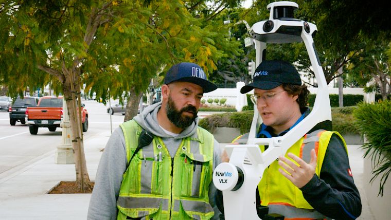
Join Noah Eckhous from NavVis and Mike Walle from Denn Engineers in downtown Culver City to explore how SLAM-based data capture technology transforms topographic survey workflows.
In this video, we embark on a detail survey project covering approximately 3,200 linear feet of cityscape, from back of walk to back of walk, alongside an ADA topographic survey of an intersection. This comparative test showcases the efficiency and data richness of NavVis technology over conventional methods.
Mike also shares his insights into the significant time savings achieved and the incredible amount of detailed data collected in a fraction of the time typically required. The discussion delves into practical applications of this technology such as ADA compliance for ramps and outdoor seating arrangements for restaurants post-COVID.
Watch the full video here to learn more about how using advanced scanning technology in surveying projects can save you time and money and enhance data quality.

Value staying current with geomatics?
Stay on the map with our expertly curated newsletters.
We provide educational insights, industry updates, and inspiring stories to help you learn, grow, and reach your full potential in your field. Don't miss out - subscribe today and ensure you're always informed, educated, and inspired.
Choose your newsletter(s)


