Reuniting the Geospatial Industry
Back in Business at Intergeo
The vibe at Intergeo 2022 felt almost just the same as pre-pandemic times, and a wide range of innovative hardware and software solutions were on display. The geospatial industry is clearly back in business! Moreover, with a strikingly high number of companies already signed up to exhibit next year, it seems to be all systems go for an even bigger and better Intergeo 2023 in Berlin.
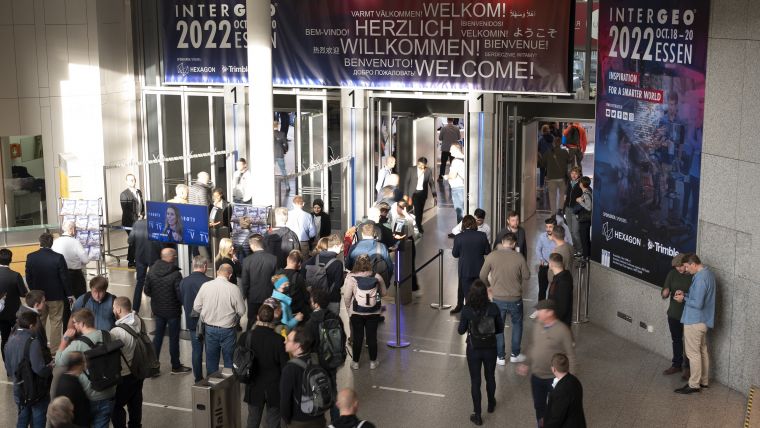
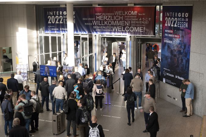
Intergeo 2022 was the first in-person edition since COVID-19 brought the world to a standstill, so many geospatial enthusiasts had been looking forward to it for a long time. And based on the vibe at the exhibition centre in Essen during the three days of the event, they were clearly not disappointed, since the atmosphere at the world’s leading trade show and conference for the mapping and surveying profession felt almost just the same as pre-pandemic times.
While this year’s edition of the event was officially described as a ‘hybrid’ version, it can actually be seen as a major step towards things going back to normal. Having said that, COVID-19 had clearly left some traces, since a number of exhibitors were present with smaller booths than in previous years. Their restraint is understandable, as the ongoing uncertainty in the world has made many businesses think twice about budgets and investment decisions.
Excited to See Hardware, Software and Peers
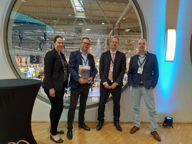
However, any hesitation rapidly made way for excitement as soon as Intergeo 2022 opened its doors in Essen, the second-largest city in the Ruhr region, which is Germany’s largest urban area and was the beating heart of the German Wirtschaftswunder (economic miracle) in the 1950s and 1960s. For many of the roughly 14,000 visitors, one of the key reasons to attend had clearly been to meet up with old (and new) friends and finally see their peers in the geomatics community again in real life, which is of course so much more enjoyable than trying to interact on a screen. This definitely added to the lively atmosphere that filled the air in the exhibition halls.
Needless to say, Intergeo 2022 was much more than an occasion to meet people in person. It was also the perfect place to get a major update on the latest hardware and software solutions that are driving the geospatial industry’s growth, ranging from terrestrial surveying solutions to unmanned aerial vehicles (UAVs or drones) and other automated solutions for capturing the world’s reality. Visitors could also see numerous examples of how today’s advanced geoinformation systems and building information modelling (BIM) solutions are unleashing their potential in data analysis, monitoring and decision-making support. This year, there was a special focus on digital twins, which are increasingly being used to bring static models to life with dynamic, real-time information and to simulate wide-ranging scenarios in their reflected reality. On the topic of digital twins, next year’s host city of Intergeo is currently working on an interesting real-life use case. In a regeneration project that is set to transform a 73-hectare site into a modern urban district called Siemensstadt Square, Berlin’s newest neighbourhood will be ‘built’ twice: first in the digital world and then in the real one. A holistic digital twin will serve as the foundation for both the construction and the subsequent operation of the whole district.
Digital Twins and the Metaverse
Digital twins were also in the spotlight during the traditional press conference on the second day of Intergeo. One of the speakers was Hansjörg Kutterer, who will be succeeded as president of the German Society of Geodesy, Geoinformation and Land Management (DVW) by Rudolf Staiger from January 2023 onwards. Kutterer stated that the Earth is changing rapidly and that we need to map, model and run simulations as the basis for discussions and scenario analysis to support informed decisions at the level needed. The geomatics profession is a main player in this, he explained, which also requires us to think big and merge our different views and competencies into something bigger. By ‘something bigger’, Kutterer was referring to the metaverse, which was a buzzword at this year’s event. Although the metaverse may still be a somewhat abstract term for many people, it can be seen as the evolution of ‘Industry 4.0’ and the Internet of Things. In the metaverse, the use of AR and VR will bring physical things into the parallel digital world. Geospatial data will be essential to create dynamic digital twins that will form important building blocks of the metaverse and add value.
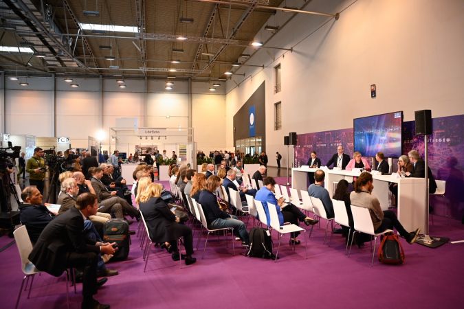
Barbara Ryan, executive director at the World Geospatial Industry Council (WGIC), described the metaverse as the ‘forcing function’ for people. The term ‘metaverse’ was first coined around 20 years ago in the science-fiction novel Snow Crash, written by Neal Stephenson, she explained. “That shows how fast things move, and there is no doubt that one day we will all be ‘living’ in two worlds: the virtual and the physical.”
Thomas Harring, president geosystems at Hexagon, stated that digital twins are already a kind of metaverse, but the metaverse will be even more complex and in real time. “This will drive awareness among consumers and the broader community of the technology and what geospatial data can do. Hopefully it will also help to attract young people or new talent to our industry.”
Geospatial Data to Combat Climate Change
Climate change is undoubtedly high up on the list of priorities for the global community to solve. Therefore, it was fitting that the press conference addressed how geospatial solutions could help the world to combat this societal challenge or adapt to its effects. Kutterer commented that he regards a digital representation of the environment, including the landscape, coverage, buildings and physical processes, as the basis for enabling decision-makers in many disciplines – ranging from architects and biologists to civil engineers and mayors – to mitigate the impact of climate change.
Martina Klärle, a climate expert at the Frankfurt University of Applied Sciences and project leader at caREL (a research platform using geospatial data to support climate goals, including Europe’s ambitions to become the world’s first climate-neutral continent), urged the geospatial industry to fight climate change with all the available tools. She described it as our duty to share all the data with the world for free in order to empower our united attempt to meet the targets of the Paris Agreement.
Scott Crozier, vice president, survey and mapping at Trimble, agreed that sharing information is indeed absolutely critical, and said that the industry can help by sharing the abundance of relevant geodata collected with today’s advanced mapping and surveying solutions. Thomas Harring concurred that it is important for decision-makers to access to all the information they need, adding that all the data can be used to make a giant impact.
The Role of Intergeo in Pushing the Geospatial Industry
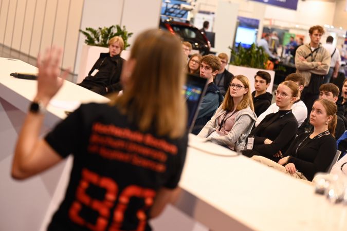
On the third and final day of Intergeo, I caught up with DVW’s Kaja Hoppe (head of business development) and Christiane Salbach (director), together with Hinte (the organizer of Intergeo), in the press lounge for a cup of coffee. With the number of visitors in Essen exceeding expectations and lots of visible signs of engagement, they were clearly pleased with the success of the event. Besides having a strong sense of the industry reuniting, they were also aware of many new contacts being made – often by chance – which illustrated the open nature of the geospatial community. Notably, the percentage of female visitors had increased, and so too had the number of students. In the context of the talent shortage and the ever-growing demand for new graduates in the geospatial labour market, the presence of so many youngsters is encouraging.
In summary, it is fair to conclude that Intergeo 2022 in Essen marked a strong return of the annual event which turns a German city into the global capital of the mapping and surveying sector for a few days each autumn. As a result, things now look very promising for next year’s Intergeo, which will be held in Berlin. A notably high number of companies have already signed up to exhibit next year, and the ‘Secure your booth’ corner in one of the halls was constantly busy. “Rebookings are going through the roof,” confirmed Salbach, who praised the unique appeal of Berlin as an extra factor boosting the potential of Intergeo 2023 to be an even bigger success. Additionally, the organizing committee intends to further broaden the role of content in order to spread the word about the interdisciplinary potential of geospatial, for example regarding energy, infrastructure, urban planning and rural development. Hoppe: “We aim to create better awareness of what our industry can do, both for politicians and the public.” Moreover, networking will be given an even bigger role in Berlin, and there will be a greater focus on the next-generation surveyor. As Martina Klärle said during the press conference: “If you want to be a hero, become an engineer.” There are plenty of role models in the geospatial industry and, at GIM International, we are delighted to support Intergeo’s efforts to give them an international voice.

Value staying current with geomatics?
Stay on the map with our expertly curated newsletters.
We provide educational insights, industry updates, and inspiring stories to help you learn, grow, and reach your full potential in your field. Don't miss out - subscribe today and ensure you're always informed, educated, and inspired.
Choose your newsletter(s)


