River monitoring network in northern Germany – a case study
In July 2022, an environmental disaster hit the Oder River, a vital waterway for both Poland and Germany. The mass die-off of fish triggered an extensive investigation into the possible causes, but could this tragedy have been prevented?
Early detection enables rapid feedback and effective countermeasures, so developing modern sensor networks for water quality monitoring is critical for the assessment, protection and restoration of aquatic ecosystems. A real-time monitoring network makes it possible to ascertain the extent of the water quality degradation and develop an appropriate response before an issue becomes a larger problem.
EvoLogics offers a wireless, low-maintenance monitoring network for tracking water parameters near industrial sites, and an overview of such systems and their future outlook and potential uses are provided below.
The problem
A mining industry client of EvoLogics wished to use live data from a monitoring network to measure the impact of its wastewater releases into a river in northern Germany. Several water parameters had to be measured with real-time remote access to the data. Other requirements were ease of deployment and low maintenance without the need for divers.
The solution: system overview
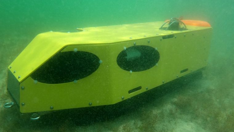
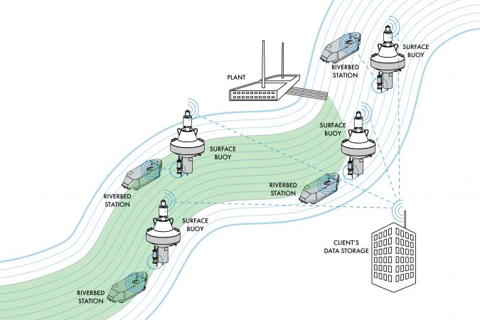
The monitoring network developed by EvoLogics consists of a number of autonomous underwater sensor stations on the riverbed, each paired with a buoy on the surface.
Each water-filled riverbed station carries several sensors, tailored to the client’s needs: in this case, a CTD multiparameter probe measures water conductivity (to estimate the salt content), temperature and depth, and an ADCP (acoustic Doppler current profiler) tracks the water current velocity. The station is equipped with an EvoLogics underwater acoustic modem for wireless transfer of the sensor data to the surface buoy, and is powered with a high-capacity underwater battery.
The battery-powered buoy is a platform for the communication equipment: it carries GNSS, Wi-Fi and LTE antennas for connection to the client’s central server and an underwater acoustic modem for retrieving sensor data from the riverbed station. The system is therefore cable-free.
System operation
Optimal locations for station placement and the frequency of data sampling were established together with hydrographic surveyors, who were partners in the project, and the stations were spaced along the river downstream from the plant, with one station placed upstream to obtain control samples. This setup allows the tracking of small differences in water parameters from one station to the next.
The network takes measurements at a pre-defined sampling rate and provides insight into how the plant’s scheduled discharges are processed by the river’s ecosystem. The water quality data provided makes it possible to manage the plant’s discharge: in low waters with high concentrations of pollutants the output is reduced, while high water levels and strong currents mean it is safe to increase the volume of discharge. The data also makes it possible to separate the impact of a particular discharge from other sources of industrial pollution.
The riverbed station’s acoustic modem sends water quality data from the sensors to the modem on the surface buoy at pre-defined time intervals. Using an LTE connection, the surface buoys transmit geo-referenced data to the client’s servers. To conserve energy, the whole system powers off between the sampling-transmission cycles: the EvoLogics modems are equipped with a ‘wake-up’ module that turns the system elements on and off into a ‘sleep’ mode. If for some reason the surface station cannot be reached over the underwater acoustic channel, the sensors continue operation and the data is stored onboard the riverbed station for later retrieval, so that no measurements are lost.
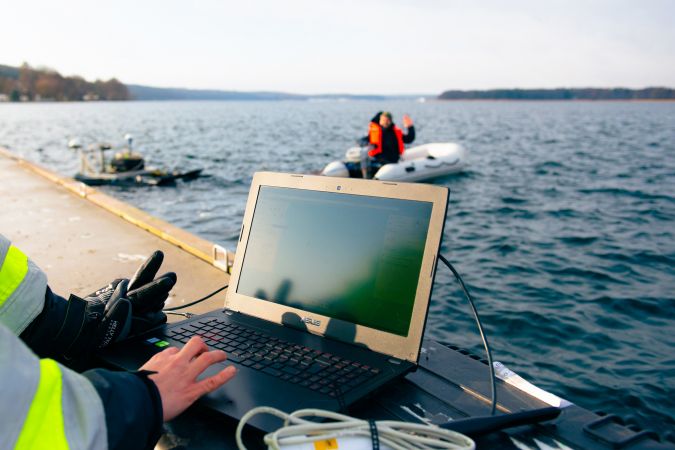
The monitoring network is cable-free and operates autonomously all year round, including at the high tide when the river is filled with debris. Maintenance is required approximately once a year. Recovery of the riverbed stations for maintenance does not require diver services, as each station is fitted with a detachable float and tether. The float release is triggered by an acoustic command from the buoy; it then surfaces and the station can be pulled up to the support vessel using the tether line. Maintenance procedures include changing the batteries, inspection for corrosion or bio-fouling (accumulation of unwanted biological material), software updates, sensor calibration and functionality testing.
EvoLogics and the project service partners have been operating the water monitoring network for over a year, 24/7, in various weather conditions and in high and low waters and strong currents. The only problem encountered was related to underwater dune migration near one of the stations that eventually required recovery and repositioning of the station. The team gained valuable experience by exploring this issue. Otherwise, the autonomous network has presented no issues calling for immediate service actions.
Future outlook
River monitoring networks are proving crucial for the effective management of the environment. Science and business must therefore work together to further develop and expand these systems.
Rivers can be monitored for a variety of metrics and properties. Research-focused systems can be designed to investigate aspects of river hydrology and water quality to provide a better understanding of human impact. Examples of commercial applications are systems designed to monitor industrial impacts, such as turbidity during a dredging project, discharge and flow rates at a fish hatchery, or nutrient loads near an agricultural operation. A water monitoring network is also necessary for tracking the progress of ecological restoration efforts.
Whatever the nature of the application, the autonomous monitoring network described here can be easily adapted for various scientific or commercial activities, as the riverbed station can include any sensors required to track a particular set of parameters. The network also has great scalability potential: the networking features of EvoLogics modems can enable different architectures for underwater communication, where one surface buoy can receive data from several riverbed stations, or from multiple stand-alone sensors interfaced with underwater acoustic modems. Moreover, monitoring stations can be equipped with underwater imaging sonars and/or cameras and enhanced with neural network modules with object recognition. Objects in the sonar or camera image/video feed can then be automatically recognized, for example to count or categorize them, opening up new opportunities for employment of the network.
To summarize, a scalable multi-instrumental river monitoring network that provides multidimensional information about the quality of water can be a versatile tool for assessing the ecological status of an area. EvoLogics is looking into the further development of the concept for future and ongoing projects.
On 18–20 April 2023, the team will happily discuss the system and the company’s latest updates at Ocean Business 2023 in Southampton, UK – stand M4.
More information:

Value staying current with geomatics?
Stay on the map with our expertly curated newsletters.
We provide educational insights, industry updates, and inspiring stories to help you learn, grow, and reach your full potential in your field. Don't miss out - subscribe today and ensure you're always informed, educated, and inspired.
Choose your newsletter(s)


