Scanning and 3D modelling for efficient highway surveys
How aerial laser scanning point clouds help to automate road surveying
Thanks to rapid improvements in aerial laser scanning systems, they offer great potential in road surveying compared with traditional photogrammetry-based methods. Using the high-density 3D point clouds resulting from aerial scanning, highway surveyors can reconstruct accurate 3D models of road pavements and lateral terrain. This supports road safety inspections and highway expansion planning with higher accuracy and less heavy labour. This article provides inspiring insight into the use of laser scanning point clouds in highway surveys.
Due to the increasing number of vehicles and the changes in people’s transportation needs, upgrading existing highways has become an important issue worldwide. Drawing up practical construction plans and estimating potential costs both rely on high-quality surveys which traditionally require considerable human labour, whether for GNSS field surveys or manual lane digitization. The popularization of mobile laser scanning has drastically changed this situation for surveyors. Aerial laser scanning (ALS) collects large-area point clouds with a point density of up to 10-50pts/m2. Thanks to intelligent point cloud processing techniques, these can be used for automated digital terrain model (DTM) reconstruction and pavement feature calculation in easy-to-use 3D models of highways.
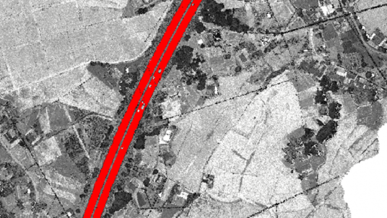
In general, the workflow starts with fusing multi-source point clouds and recognizing terrain points and road pavement areas. Road alignments and terrain models are then digitized accordingly, facilitating the construction analysis and simulation (Figure 1).

Fusing multi-source point clouds
Fusing multi-source point clouds by transferring them to a unified coordinate system is fundamental to practical applications because this process directly determines the global accuracy of point clouds. The horizontal root mean square error (RMSE) of original ALS point clouds can reach over 20cm. The fusion contains error adjustments between flight strips, registration of multi-platform data (Figure 2) with overlapping regions, and global coordinates refinement with control point restrictions. In a highway laser scanning project, terrestrial laser scanning (TLS), vehicle mobile laser scanning (MLS) or even backpack laser scanning (BPLS) will sometimes be used as a supplement to ALS, to present detailed point clouds at key elements including bridges, tunnels and interchanges. These scanning techniques including ALS show very different point cloud features (density, distribution, accuracy, etc.) which can pose serious challenges to their fusion. To overcome the drawbacks of traditional point-to-point registration methods, feature-level registration methods can be applied to overlapped multi-platform point clouds. Another merit of integrating multi-platform point clouds is that it brings control points into global coordinates refinement. To overcome the difficulties associated with ground control points in ALS point clouds, TLS targets can be placed on control points and picked up in the point clouds. Constructing and optimizing a pose graph with ground control point restrictions allows multi-platform point clouds to be globally fused and refined. The RMSE of refined ALS point clouds is within 50mm horizontally and 35mm vertically, which is valid for highway surveying.

Recognizing terrain and pavement points
Original ALS point clouds of highway corridors contain plenty of off-ground points such as vegetation, vehicles, buildings and roadside fences, but these points are regarded as noise in terrain and pavement modelling. Most existing point cloud processing software solutions offer implemented off-ground point filtering algorithms to output segmented ground points, which constitute the basic data layer for DTM reconstruction. Based on these ground points, pavement areas can be recognized according to the distinct geometric and reflectance features of highways. Pavement point recognition (Figure 3) based on point cloud feature extraction generally calculates regional smoothness, intensity and connectivity, or detects road boundaries. Moreover, the ability and potential of applying deep learning-based point cloud semantic segmentation methods have been shown to simultaneously recognize terrain and pavement points. These automated point cloud classification techniques have strongly accelerated the development of highway inspection and surveying based on laser scanning.

Highway alignments extraction: a novel optimization model
Highway alignments, defined as a specific series of parametric curves, indicate typical geometric characteristics of highways such as curvature, gradient and superelevation. Horizontal alignments consist of circular arcs, straight lines and clothoids, while vertical alignments contain straight lines and parabolas. Extracting highway alignments based on pavement point clouds requires localizing curve segments and calculating their curve parameters. Various highway structures that clearly reflect the highway alignments include pavement boundaries and lane markings, both of which can be delineated from pavement point clouds. To increase the robustness when facing complex scenes and scanning conditions, a multi-constraint optimization model is designed for calculating highway 3D alignments parameters. This model incorporates highway alignments design specifications – fitting residuals from reconstructed alignments to road boundaries and lane markings – and smoothness between adjacent curve segments, and therefore finds the globally optimized highway alignments through iterative optimization. With this model, the 3D alignments extraction results achieved 15cm accuracy, with correctness and completeness exceeding 99.25%, thus satisfying the needs of highway design and construction. Moreover, experiments show that this method is effective at highway interchanges with little human intervention, where complex curve segment combinations exist.
Conventionally, surveyors are burdened with manually delineating road boundaries. Despite the improvements in point cloud semantic segmentation, the gap between discrete road marking and boundary points and the parametric representation of as-built highway geometry still limits automation. This highway alignments extraction method evidently increases the working efficiency and quality.

Highway 3D model reconstruction
Highway 3D models are high-resolution digital representations of highways and their surrounding terrain. Conventionally, road surveyors used to interpolate 3D models with sparse ground GNSS measurements, which is time-consuming and costly and limits the accuracy of the 3D models. ALS point clouds provide much denser data points at centimetre-level accuracy. Nearly all recent studies concerning the generation of high-quality models have mentioned the necessity of extracting terrain break lines as constraints to better presenting terrain features. Besides that, in highway scenes, the road boundaries are in accordance with the road alignments. With the result of alignments extraction and the road boundary points, smooth road boundaries are supposed to be supplemented as additional break lines. Without the constraints of the extracted alignments, the generated 3D model will be over-smoothed near the boundary of highways. Experiments report that, with the supplemented highway alignment restrictions, the RMSE of the 3D model near road boundaries is significantly reduced from 31.9cm to 2.6cm. The RMSE of the generated 3D model is 2.4cm on pavement and 5.8cm on hills and slopes. Figure 4 shows the highway alignments and 3D models at interchanges.
Software development and applications
To make it more convenient for highway designers and constructors to use these results, not only should the point cloud processing software implement the aforementioned automated algorithms, but it also needs to produce customized output that conforms to user habits. The most important are the highway centrelines and cross-sections (Figure 5), and the interpolated terrain grid model. Engineering applications include driving safety analysis, road visibility simulation, designing and earthworks estimation for highway extension.

Conclusion
To summarize, laser scanning is being increasingly used in highway surveying to increase the quality and efficiency of 3D modelling. Key considerations include the fact that the fusion of multi-source point clouds with ground control points is essential in practical applications because this determines the absolute accuracy of data. Similarly, effectively segmenting terrain and pavement points is fundamental for highway 3D modelling. Road alignments extraction presents the detailed geometric feature parameters of highway pavement. High-quality highway 3D models can be reconstructed with centimetre-level precision to support construction analysis. Last but not least, it is important to offer customized digital output according to the habits of designers and constructors.
Acknowledgements
This study was jointly supported by the National Science Fund for Distinguished Young Scholars (No. 41725005) and the National Natural Science Foundation Project (No. 42130105).
Further reading
- Zhou Y, Huang R, Jiang T, et al. Highway alignments extraction and 3D modeling from airborne laser scanning point clouds. International Journal of Applied Earth Observation and Geoinformation, 2021, 102: 102429.
- Dong Z, Liang F, Yang B, et al. Registration of large-scale terrestrial laser scanner point clouds: A review and benchmark. ISPRS Journal of Photogrammetry and Remote Sensing, 2020, 163: 327-342.
- Zhou Y, Han X, Peng M, et al. Street-view imagery guided street furniture inventory from mobile laser scanning point clouds. ISPRS Journal of Photogrammetry and Remote Sensing, 2022, 189: 63-77.

Value staying current with geomatics?
Stay on the map with our expertly curated newsletters.
We provide educational insights, industry updates, and inspiring stories to help you learn, grow, and reach your full potential in your field. Don't miss out - subscribe today and ensure you're always informed, educated, and inspired.
Choose your newsletter(s)


