Atmos UAV and Topcon Join Forces for RTK Reference Network Solutions
Atmos UAV has formed a new partnership with Topcon towards a base station-free era. Atmos UAV is a fast-growing Dutch drone manufacturer that develops high-end VTOL fixed-wing drones for surveying and mapping applications. In recent years Topcon, an industry-leading designer, manufacturer and distributor of precision measurement and workflow solutions, has developed and optimized its own GNNS RTK Reference Network, TopNETlive, which will now be available with every Marlyn unit.
TopNETlive is a subscription-based solution that offers real-time GNSS corrections. Designed to meet the unique needs of its users, the platform provides a wide range of subscription services such as Network RTK, RTK, DGNSS, and Agriculture-specific GNSS. Managed and operated by Topcon geodesy teams, and with multiple stations for redundancy at hand, TopNETlive brings survey-grade results without the need for a base station.
GIS applications
When it comes to land surveying and construction applications, TopNETlive delivers high-accuracy positioning to professional surveyors through a 24/7 consistent and reliable access. Since base stations are no longer necessary, greater efficiency is gained in the field that results in higher production and decreased costs.
Similarly, in GIS applications the platform is ideal for utility mapping, asset management, and in general projects that demand precise GIS data collection. Fully interoperable with third-party owners, GIS professionals can rely on both real-time differential corrections, as well as having access to raw data for post-processing.
“Keeping the needs of our users in mind, we try to take steps that will make their work easier and more efficient in the field,” said René Worms, commercial director at Atmos. “We believe this partnership will add great value to our platform and streamline operations for our customers,” he concluded.
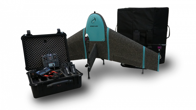
Marlyn is a fully autonomous hybrid (VTOL & fixed-wing) unmanned aerial vehicle (UAV or 'drone') for mapping and surveying. With its patented design that combines the best of both worlds, Marlyn can take off vertically from anywhere, and map quickly and efficiently producing high-quality outputs for professional users. The UAV is built to perform in harsh and windy conditions, while its easily swappable multiple payloads provides operators with an unprecedented flexibility.

Value staying current with geomatics?
Stay on the map with our expertly curated newsletters.
We provide educational insights, industry updates, and inspiring stories to help you learn, grow, and reach your full potential in your field. Don't miss out - subscribe today and ensure you're always informed, educated, and inspired.
Choose your newsletter(s)


