BIM: A New Model for Surveyors
Important Opportunities and Challenges for Surveyors
Building information modelling (BIM) is one of the most intriguing opportunities for surveyors to come along in years. This model-based approach combines technologies and processes to support the efficient creation and use of information for building construction and operations. Because of its strong ties to spatial information, BIM offers a familiar landscape and rich possibilities for surveyors and other geospatial professionals, according to Ron Bisio, vice president of Trimble Geospatial.
The opportunities stem from the growing acceptance of BIM within the surveyor’s traditional client base of engineers, architects and property owners. By gaining an understanding of the key concepts of BIM and of how their skills and tools can contribute to BIM-based approaches to construction, surveyors can position themselves to effectively serve these clients’ needs. The perception and use of BIM varies with the needs of each project’s stakeholders. While spatial information is a key component of many BIM processes, it is only a portion of the information that project stakeholders need to be able to move from a design model to physical construction and operation. Additional data on a structure’s individual components – including descriptions, specifications, sourcing, installation, maintenance and asset management – is used by multiple disciplines. In addition, BIM often includes project management and the 4D and 5D processes that bring scheduling and costing components into project modelling.
For surveyors working on BIM-based projects, flexibility is an essential characteristic. A surveyor is not expected to be an expert on all aspects of a BIM-based project, and nor is the architect, structural engineer or plumbing contractor. However, it is certainly important for the surveyor to understand the role of spatial information in the myriad BIM processes. In addition, the surveyor must know how to apply his or her skills to ensure accurate, efficient utilisation of spatial data. Surveyors and other geospatial professionals would do well to become highly skilled in BIM concepts and technologies that rely on spatial information. By doing so, they can provide valuable services throughout a project’s development, construction and operation stages.
Automation in Construction
The basic concepts behind the benefits that BIM brings to the surveyor’s clients have been in place for years. BIM begins with a digital approach to a project’s processes. Automation and digital technology have demonstrated their value in a variety of industries for decades. Computer-aided design and manufacturing (CAD/CAM) has transformed industrial processes and produced cost-effective increases in productivity, capacity and quality. In many businesses, automation is essential to remain profitable and competitive. The automation trend will continue and will push automated processes and equipment into new applications and arenas, including some already familiar to surveyors.
But even in the face of documented benefits, some industries remain slow to adopt new technologies – and the construction industry is one of them, according to a 2015 report by McKinsey & Company. Automated machine guidance is gaining acceptance in construction projects that involve significant earthwork, but those tasks represent a relatively small portion of the overall construction market. A much larger segment, building construction, is filled with opportunities for improved efficiency and productivity. Within the building industry, architects, engineers and project owners use BIM to improve quality and reduce costs throughout a project’s life cycle. Because surveyors can participate in multiple BIM processes, they stand to benefit as the use of BIM takes hold.
Geospatial information is already essential during the planning and design phases. But more – and larger – opportunities for surveyors can be realised when BIM is carried into the subsequent phases of a building project, including construction, inspection, financial control, project management and beyond. A 2014 analysis by McGraw-Hill found that contractors report the return on investment (ROI) for BIM ranges from 10 to 25 percent. The ROI increases as BIM is used in more stages of a project and as the contractor’s experience and engagement with the technology increases. The report noted that BIM can be especially valuable in the later phases such as building operations and life cycle management. Surveyors can play a key part in these later phases through collection and management of as-built and inspection data. Project owners rely on as-built information in BIM databases when formulating decisions on upgrades and modifications over the life of the building.
BIM is also moving beyond the arena of traditional building construction. Projects such as civil infrastructure, utilities, power stations and industrial facilities all benefit from BIM’s ability to provide strong integration of information and workflows together with streamlined interaction among owners, contractors and consultants. The key advantages include: increased collaboration among owners and designers; reduced errors and omissions; the use of virtual construction and constructability analysis to reduce rework; and detailed as-built information for use in operations and asset management.
Geospatial Information for BIM
The awareness of BIM is accelerating in certain sectors within the architecture, engineering and construction (AEC) markets. Some stakeholders in the construction arena have also recognised the potential of BIM to produce rapid improvements. Disciplines including general contractors, fabricators and mechanical, electrical and plumbing (MEP) subcontractors were among the early adopters and have been followed by design professionals such as architects and engineers.
Geospatial data from ground and aerial sources is one of the first and most important layers in a construction project model. The presence of geospatial information in BIM helps to streamline the collaborative processes of feasibility analysis, planning and permitting. Accurate geospatial information also helps to prevent surprises during the main construction work. As BIM takes hold, surveyors are learning new skills and creating innovative approaches to meet the expanding needs of their clients.
While many of the solutions that surveyors use for a BIM-based project are familiar and something they commonly utilise, newer geospatial technologies are garnering more attention. This is due in part to BIM’s strong capabilities for 3D modelling and visualisation. Aerial and terrestrial photogrammetry and Lidar can provide fast, non-intrusive measurement with rapid processing and delivery of results. Photorealistic 3D models of existing conditions can be merged with design data to support visualisation and design work. Traditional ground surveys remain vital components of any building project. Data from global navigation satellite systems (GNSSs) and total stations can be integrated with Lidar and photos to provide georeferencing and increased detail and precision for use by design and ownership teams.
A key part of sharing information during a BIM project is to ensure that all components and stakeholders are working in a common reference frame. Although important during initial planning, georeferenced positions are less critical to building construction contractors. Instead of ties to geodetic data, project coordinates are often related to building corners or grid lines. The surveyor can provide a valuable service by managing the horizontal and vertical datum transformations between the various site and building design models to establish a single, consistent 3D reference frame.
Tasks involving spatial information and positioning are abundant during construction of a BIM project. Surveyors can provide expertise and tools for layout, utility connections, quality control, volume measurements and as-built inspections. For example, surveyors might use GNSSs or total stations to confirm the correct location of concrete forms prior to pours. After a pour, a surveyor can use a laser scanner to quickly check floors and walls for flatness, plumb and bulges.
A recent project at a large water treatment plant near Washington DC, USA, illustrates how scanning can be combined with BIM during construction. Project surveyors used a scanner to confirm dimensions and fit of large pipes and structural components prior to installation. By combining point clouds with design models, the surveyors exposed a number of discrepancies between the design and physical conditions. The issues could be resolved before problems arose; components could be modified during fabrication to ensure accurate fit when installed. The technique prevented extensive – and very costly – rework.
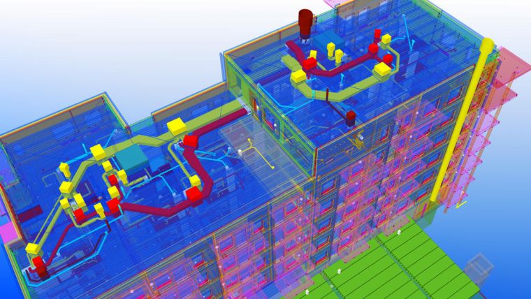
Many other measuring tasks, such as layout for a building’s MEP systems, are commonly performed by subcontractors and tradespersons. New tools developed specifically for these tasks can take data directly from the BIM database and guide the tradespersons through the positioning and layout processes. The tools provide accurate measurements while interacting with the workers using simple, familiar terms and workflows. Surveyors support this work by creating and maintaining the coordinate framework and extending it to include interior horizontal and vertical control points.
Emerging Technologies and Platforms
One of the most valuable characteristics of BIM is its capacity for close collaboration among stakeholders. Cloud-based services support sharing and interaction by a wide variety of disciplines that use dozens of different file formats and work processes. Systems can combine models from multiple sources such as structural design, utility services, MEP and more into an integrated model for visualisation, analysis, construction planning and project management. Accurate spatial information is essential and surveyors can develop and maintain key data throughout the project.
Effective collaboration relies on efficient information exchange. File management, applications software and visualisation tools can all reside on a central server. By using cloud services, remote workers can access site data and develop changes or instructions with the confidence that the information will be immediately available to other team members. Additionally, cloud-based services provide strong version management and can automatically push design updates and work orders to the necessary people and locations.
BIM tools for visualisation enable users to see 2D and 3D images of the project during all phases including design models, construction progress and existing conditions for life cycle upgrades and facility management. Recent advances in technologies for mixed reality can support complex models to allow stakeholders to see and move around in the building model. Models can be experienced as stand-alone models or overlaid into existing structures to show users how designed features will interact with existing conditions.
Surveyors should think of BIM as a niche opportunity, albeit a very big niche. Because of their expertise with spatial information, surveyors and other geospatial professionals are well positioned to become trusted participants in BIM-based construction projects. They can leverage their skills in 3D data management, modelling and visualisation to support the design, build and operate processes that lie at the core of BIM. By developing and maintaining connections with stakeholders throughout the project, the surveyor sets the stage for long-term, profitable relationships.
Mixed Reality: Ready for Prime Time
Mixed reality (sometimes referred to as ‘augmented’ or ‘modified’ reality) combines digital models with the real environment to produce a view of the physical world overlaid with ‘virtual’ information. The techniques of mixed reality allow users to experience new or modified conditions in relation to an existing physical setting. This differs from virtual reality commonly found in gaming, where nothing is real and users are isolated from their physical surroundings. Instead, mixed reality enables the user to control the amount of digital content that is overlaid onto the physical world.
The growth of mixed reality stems from advances in both hardware and software to simplify a very sophisticated technology. One example is the Microsoft HoloLens, a wearable device that can map its environment and then add digital content. That makes things simple for the user – there is no need to somehow locate and orient the device in a location; it does that for itself. Other devices, such as the Google Tango tablet, provide similar capabilities.
On the software side much of mixed reality has roots in gaming, which opened the door for virtual reality at the consumer level. Gaming provides a powerful, hardware-agnostic platform for software development. This approach enables developers to port applications to multiple devices, which is an important advantage in today’s world of rapidly changing hardware capabilities.
Mixed reality is finding a home in BIM. For example, Trimble’s SketchUp Viewer software enables users to export and visualise models on HoloLens. A user can look at a model at a smaller scale, so one could ‘set’ a model on a table top like a little hologram and rotate it around for different views. Alternatively, it is possible to display the model at a 1:1 scale and move around inside it to experience the relation of the model to the physical environment.
Industry experts expect that the 1:1 scale will be where people start to see the most value in mixed reality. In one case, a designer took a client on-site and used mixed reality to show the client a proposed modification to a building. Almost immediately, the client moved from the “Wow, this is amazing technology” reaction to analysing the scene and suggesting changes to the design. Although the client had seen 2D and 3D depictions of the project on a computer screen, the mixed reality enabled him to spot the necessary changes. The team could then implement the revisions before construction began and avoid costly rework later in the project.
The large and complex 3D models common to BIM can tax the capability of handheld or wearable technologies. Developers are again tapping gaming technologies to leverage algorithms that optimise visualisation of large-scale models. While the technologies continue to evolve, modified reality has already proven its ability as a common and valuable tool for surveyors, architects, engineers and their clients.
About the Author
Ron Bisio joined Trimble in 1996 and has held several marketing, sales and general management positions prior to taking over worldwide responsibility for Trimble’s Geospatial Division as vice president. He holds a master of business administration from the University of Denver, a master of regional planning from the University of Massachusetts, and an undergraduate degree in geographic information systems & cartography from Salem State University in Salem, Massachusetts, USA.

Value staying current with geomatics?
Stay on the map with our expertly curated newsletters.
We provide educational insights, industry updates, and inspiring stories to help you learn, grow, and reach your full potential in your field. Don't miss out - subscribe today and ensure you're always informed, educated, and inspired.
Choose your newsletter(s)


