Leica Geosystems Introduces Detection Solution for Utility Construction
This article was originally published in Geomatics World.
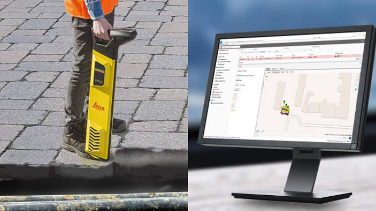
Leica Geosystems, an industry leader of measurement technology, has announced the newest solution for utility and excavation professionals - the Leica DD SMART utility locator series, signal transmitters and DX Shield software.
The Leica DD SMART utility locator series uses digital signal processing to automatically detect utilities and underground assets deeper, faster and more accurately. New technology from DX Shield software records information to manage site activities and map buried utilities.
“We have used Leica DD SMART locators in conjunction with the DX Manager Shield software to provide reports showing an overview of where and when the locators have been used. This has allowed us to gain a better understanding of system use and make improvements where necessary,” said Tim Swan, senior engineer at Costain, a technology-based engineering solutions company.
A Scalable Single-source Platform
The new SMART utility locator solution allows users to collect, transfer and access data remotely to a hosted service for multiple users, across multiple sites. The DD230/220 SMART utility locators use on-board locate alerts, video support and automatic locate processes to reduce time scanning utilities and minimise utility damage. The utility locators are scalable and designed with the latest Bluetooth technology, providing a wire-free connection to field controllers and mobile phone devices.
Understand Site Activity
DX Shield software solution allows users to gain a better understanding of task performance and site complexities with easy-to-use reports, activity visualisation, and locator fleet overviews. A cloud-hosted platform transfers data directly to the field to provide a fast and convenient view of the product use, reducing utility strikes and saving direct repair costs and project downtime.
“We developed the DD SMART utility locator series with the latest Digital Signal Processing technology so users can identify the smallest utility signals, even in congested areas, in an intuitive and automated way. Paired with the DX Shield software solution, users of DD SMART have an overview of where, when and how their detection tools have been used, demonstrating compliance, managing competence, and helping users to protect their staff, assets and reputation,” said Andrew Allen, product manager at Leica Geosystems.
For more information visit https://leica-geosystems.com/products/detection-systems/dd-smart-utility-locators

Value staying current with geomatics?
Stay on the map with our expertly curated newsletters.
We provide educational insights, industry updates, and inspiring stories to help you learn, grow, and reach your full potential in your field. Don't miss out - subscribe today and ensure you're always informed, educated, and inspired.
Choose your newsletter(s)


