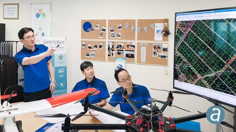
SimActive Enables South Korean Government's First Drone Mapping Project
SimActive, a leading developer of photogrammetry software, has announced it has enabled the first government UAV mapping project in South Korea. Asia Aero Survey (AAS), a SimActive regional partner, used Correlator3D for the public survey delivered to the Korean National Geographic Information Institute (NGII) and the Korean Association of Spatial Information, Surveying & Mapping (KASM). While such projects were previously conducted using manned aircraft, a drone was preferred due to the difficulty in accessing the area of interest through traditional aerial and ground surveying methods.
The NGII officially published guidelines for public surveying and mapping with drones in March 2018, with the AAS project being the first delivered and accepted as adhering to the new guidelines. AAS is also deploying UAV solutions with hyperspectral and Lidar for other projects in conjunction with SimActive software.
Correlator3D software is an end-to-end photogrammetry solution for the generation of high-quality geospatial data from satellite and aerial imagery, including UAVs. SimActive has been selling Correlator3D to leading mapping firms and government organizations around the world, offering photogrammetry software that is able to perform aerial triangulation (AT) and to produce dense digital surface models (DSM), digital terrain models (DTM), point clouds, orthomosaics and vectorised 3D features.

Value staying current with geomatics?
Stay on the map with our expertly curated newsletters.
We provide educational insights, industry updates, and inspiring stories to help you learn, grow, and reach your full potential in your field. Don't miss out - subscribe today and ensure you're always informed, educated, and inspired.
Choose your newsletter(s)


