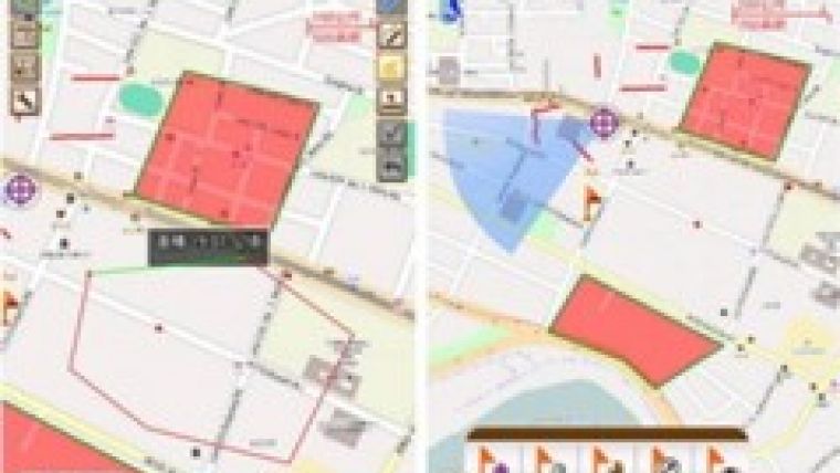
Using Web Maps in Android-powered SuperSurv 3.1
Supergeo Technologies, the global provider of complete GIS software and solutions, has announced that SuperSurv 3.1, the latest mobile GIS software for Android devices, supports the use of web maps as basemaps to complete efficient data collection with OpenStreetMap.
Integrating with GIS and GPS technologies, SuperSurv 3.1 performs accurate data collection, real-time positioning, map display and the waypoint tool. Through working with GPS, SuperSurv 3.1 allows field surveyors to collect data of point, polyline, and polygon, as well as recording and managing waypoint and GPS tracklog.
With SuperSurv 3.1, surveyors are able to display basemaps in different types, collect spatial data with basemaps from different sources, and apply the pre-generated map (cache map) or the map service published by SuperGIS Server as basemap for their mapping applications.
Furthermore, the customisable project file allows easy connection with OpenStreetMap to enhance the efficiency of data collection without generating cache map or accessing SuperGIS Server service. The customised project file (SuperSurv Online Map Tool) and usage instructions are available on the SGDN website.

Value staying current with geomatics?
Stay on the map with our expertly curated newsletters.
We provide educational insights, industry updates, and inspiring stories to help you learn, grow, and reach your full potential in your field. Don't miss out - subscribe today and ensure you're always informed, educated, and inspired.
Choose your newsletter(s)


