The geospatial industry’s role in combating climate change
How our sector can play a key role in developing sustainable solutions
As the impacts of climate change become increasingly evident, this article zooms in on how the geospatial industry can play a meaningful role by providing accurate data and analysis to inform decision-making and guide the development of effective solutions. It is time for everyone to use their skills and knowledge to help pave the way towards a sustainable future, and there’s no better place to start than with ourselves. Therefore, this article also highlights how various companies in our industry are ‘greening’ their business.
Various international treaties make it clear that climate change is on the agenda. One of the most notable agreements at the multilateral level is the commitment of the European Union member states to achieve climate neutrality by 2050. Another example is the formulation and widespread promotion of the Sustainable Development Goals (SDGs). Meanwhile, there have been 27 editions of the United Nations Climate Change conference series since it was first held in 1995. The most well-known and impactful agreements reached are the Kyoto Protocol, which was adopted in 1997 and entered into force in 2005, and the Paris Agreement, established in December 2015. The Paris Agreement set a legally binding target to limit global warming to 1.5⁰C above pre-industrial levels, with a secondary goal of limiting warming to 2⁰C. Today, however, it is becoming increasingly clear how difficult it will be to achieve those targets. Alarm bells are ringing ever-more loudly, but the key question is whether enough government leaders will hear them.
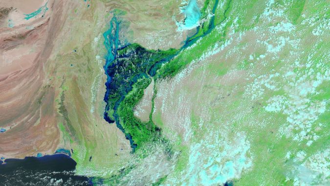
Despite all these ambitious agreements, the lack of swift, concrete action to transition to a green economy has led to a continued increase in temperature, loss of biodiversity and environmental degradation. As illustrated by Earth’s ever-louder and clearer distress signals, however, we can no longer afford to ignore the signs of climate change. In 2022, Pakistan was hit by devastating flooding, with the worst monsoon rains in decades submerging a third of the country’s land. Glaciers across the globe – including in Pakistan – are retreating at a rapid pace, which has consequences for the availability of meltwater for rivers. This, combined with the predicted decrease in snowfall over the coming decades, presents a grim scenario for glacial rivers. Meanwhile, for rivers that rely on rainfall, drought poses a major threat in various regions of the world. Additionally, the melting of the polar ice caps is causing sea levels to rise, putting the roughly 15% of the world’s population currently living in low-lying areas at extra risk. Therefore, while international treaties are crucial, the real challenge now lies in implementation and execution.
Geospatial data as a tool
The geospatial industry already plays a vital role in addressing climate change by designing and developing software tools that enable reliable geodata analysis used for monitoring, mitigating and adapting to climate change. Since many people from outside our industry are currently unaware of this, one aim should be to make our contribution more visible. Meanwhile, many geomatics specialists are examining ways in which our industry can help to halt climate change. Techniques such as radar altimetry, optical Earth observation satellites, airborne Lidar and digital cameras provide data on changes in elevation, land use, water storage, ice mass balance and more. Geodata is also crucial for responding to flooding and its value is dependent on accurate time tags and georeferencing. Therefore, geodata contains vital information for understanding and combating the effects of climate change. The challenge here is to effectively extract and convert data from multiple sources – such as satellite imagery, Lidar point clouds and radar data – into useful, quantitative information that can inform decision-makers and guide them towards implementing sustainable solutions.
Earth Archive Initiative
One of the key steps in understanding and addressing the impacts of climate change is to create a comprehensive baseline record of the current state of the Earth’s land surface. This is crucial, as it allows for the measurement of change over time by comparing actual data against the baseline data. Unfortunately, there is currently a lack of high-resolution, three-dimensional baseline datasets for most of the planet’s land surface. Without this baseline, it is difficult to effectively monitor and assess the impact of efforts to mitigate the effects of human activity and climate change. In light of this need, Christopher Fisher has launched the Earth Archive initiative to create a digital baseline of the Earth. In this large-scale international effort, airborne Lidar will be used to perform a 3D scan of the planet’s entire landmass (roughly 30% of the total surface area). The acquired data will then be combined with other open-source data, such as the Landsat archives, and field-based measurements.
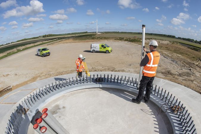
Reducing the surveying footprint
The damage caused by climate change can only be tackled by collective action and responsibility. This means that, besides offering a vital range of tools to combat climate change, businesses in the geospatial sector cannot escape the need to consider their own impact on the environment as the basis for ‘greening’ their operations, or in other words taking steps to improve the efficient use of natural resources and the preservation of biodiversity and the living environment
A closer look at surveying engineering firms and geospatial equipment manufacturers reveals an increasing trend towards adopting sustainable business practices and technologies, such as by reducing emissions and switching to renewable energy sources, and taking the environmental impact into account across their decision-making. The inspiring examples of ‘greening’ below demonstrate how industry players are taking steps to minimize their environmental footprint and promote sustainable solutions.
Companies moving towards full sustainability
Fugro is a noteworthy player in the industry as a leading provider of geodata services. The company has set a bold target of achieving net-zero emissions by 2035, and has developed a comprehensive carbon reduction plan to realize this goal. Fugro is making steady progress towards meeting or even exceeding its objectives thanks to adopting low-emission solutions for data collection and enhancing analytical capabilities to deliver more effective guidance. This environmentally friendly approach actually has a wider impact as Fugro is actively collaborating with various communities and government agencies to distribute its sustainable solutions to a larger audience. Besides transforming into a net-zero company itself, it is also setting an inspiring example by encouraging others to embrace the route towards a green economy.
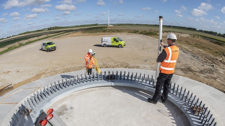
One example of a smaller business that is on a mission to provide efficient and effective survey and mapping services in an environmentally friendly manner is Geomaat. This Dutch land surveying company has incorporated sustainability and the reduction of carbon emissions as a key strategic pillar. Its offices are completely disconnected from the gas supply, and roughly 25% of its vehicle fleet is already electric – and this percentage will continue to grow as company vans are replaced by electrically powered vehicles. In addition, the company strives to minimize its environmental impact by taking its customers’ needs and expectations into account. This includes using sustainable materials and promoting the reuse of materials. The firm’s environmentally friendly practices are certified according to the ISO 14001 standard and are closely monitored as the basis for implementing necessary adjustments.
In another example, Davis Ogilvie, a renowned civil engineering firm in New Zealand, was one of the country’s first engineering and surveying companies to achieve net-zero carbon certification. To minimize its carbon footprint, this specialist in multi-disciplinary engineering, surveying and development planning services has implemented an environmental management plan and an environmental auditing process. These tools help the company to understand its impact on the environment and to develop sustainable solutions. Power and transport emissions are a major contributor to the company’s carbon footprint, so limiting these emissions is crucial to reducing the overall impact. The company therefore monitors and manages its vehicle fleet, waste stream and energy consumption. To further minimize emissions, Davis Ogilvie has installed a 20kW solar power system and biofuel tank at its Christchurch office. Additionally, the company balances its emissions by purchasing local carbon credits.
How surveying equipment manufacturers contribute
The industrial, automotive, energy and utility sectors produce approximately half of all greenhouse gas emissions globally. While companies that supply equipment to the surveying and mapping business only account for a small portion of this, a growing number of them nevertheless recognize their responsibility to make a meaningful contribution to reducing carbon emissions.
Trimble is one company that has set science-based targets, including to utilize 100%-renewable energy sources to strive towards a net-zero future. Combined with this, it is a member of RE100: a global initiative bringing together the world’s most influential businesses committed to 100% renewable electricity. The company acknowledges that it will not be easy to decarbonize its activities and its value chains while solving customer challenges such as maximizing agricultural yield amid a changing climate, or increasing performance during labour shortages. “This takes the brightest minds to provide unique ideas. It requires a culture of belonging, teamwork and collaboration,” according to Trimble CEO Rob Painter. As a result of this approach, the industry giant is installing on-site renewable energy at select Trimble locations, including a major on-site solar installation in Westminster, Colorado, USA. However, these projects are regarded as just the start. Trimble is committed to a full renewable energy future which involves using its influence to transform towards a net-zero carbon power grid.
Hexagon is another powerhouse in the geospatial industry which is taking several key steps aimed at accomplishing its sustainability goals. These steps include reducing greenhouse gas emissions in both its operations and supply chain, increasing energy efficiency at production facilities, and implementing processes for sustainable resource management to reduce waste in factories and offices. On top of this, the multinational is committed to reducing the burden of its own operations and its supply chain on water quality and air quality. Furthermore, Hexagon is integrating sustainability considerations into its product development, design and production processes, and promoting a culture of sustainability among employees to become a role model in the management of environmental issues.
To facilitate concrete actions to achieve sustainability, the company is developing and implementing a comprehensive Sustainability Programme. Additionally, Hexagon is dedicated to strictly adhering to chemical safety regulations, including the EU Directive on Registration, Evaluation, Authorization and Restriction of Chemicals in divisions that fall under such operational contexts. In support of these actions, Hexagon is implementing an environmental management system, such as ISO 14001 certification, in its major production facilities. This will ensure that the company is meeting the highest standards in environmental protection. Lastly, the company is implementing sustainability requirements for its suppliers through its Supplier Code and conducting audits to ensure that suppliers uphold the high sustainability standards.
These and many other examples make it evident that a growing number of providers of mapping and surveying solutions, whether they are based in Asia, Europe or North America, are involved in various aspects of sustainable business operations. Transparency about environmental, social and governance matters is becoming the norm, particularly among larger companies. This is being driven by their own principles and ideologies, the rising demand from customers for environmentally conscious solutions, and the effect of legislation. For example, under the European Union’s Corporate Sustainability Reporting Directive (CSRD), from 2024 onwards all large businesses will be required to disclose information about the impact of their activities on people and the environment, as well as any sustainability risks they may face. In contrast, however, small and medium-sized businesses often still find environmental legislation to be complex and difficult to understand. Such companies are key players in driving growth towards a sustainable and low-carbon economy, so there is certainly room for improvement here. Governments could play an influential role in encouraging such companies to do more to shoulder their environmental responsibility.
Conclusion
While international ambitions and agreements such as the Sustainable Development Goals and the Paris Agreement are important in addressing climate change, the real challenge now is all about their implementation and execution. Geospatial data is key to understanding and combating the effects of climate change. Therefore, the geospatial industry can make a significant contribution to sustainability by rising to the challenge of effectively extracting this data from multiple sources and converting it into useful, quantitative information. Our sector’s vital position in addressing the issue of climate change is highlighted by the attention that the topic receives from organizations such as the FIG and UN-GGIM, as well as at events like Intergeo. That is why GIM International will continue to cover this issue, aimed at further raising awareness about the industry’s role by exploring two key aspects: the use of geodata in understanding and addressing climate change, and the increasing focus on sustainability within industry players’ own operations.

Value staying current with geomatics?
Stay on the map with our expertly curated newsletters.
We provide educational insights, industry updates, and inspiring stories to help you learn, grow, and reach your full potential in your field. Don't miss out - subscribe today and ensure you're always informed, educated, and inspired.
Choose your newsletter(s)


