Total Solution from a Single Window
SECON Private Limited is an ISO 9001:2008, CMMI Level 3 and NAB-accredited firm which was established in 1981. Headquartered at Bangalore, India, it is a financially sound and zero-debt multidisciplinary engineering consulting firm. SECON is the oldest and largest commercial mapping and investigation firm in India and is also one of the country’s leading companies for civil engineering consulting.
Initially, SECON was involved in land surveys for infrastructure projects and focused particularly on pipeline and irrigation mapping. It later moved into geotechnical investigations and water resource engineering, and in 2000 SECON diversified into highway engineering and construction supervision. SECON has evolved from using a 1902 Vernier theodolite to total stations, DGPS and now into terrestrial laser scanners. The company was among the first in India to adopt CAD in the late 1980s and GIS and digital mapping technologies in the mid-1990s.
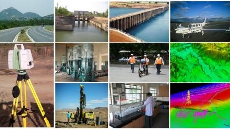
SECON currently specialises in and targets projects relating to water resources, highways, public health, electrical and geotechnical engineering, pipeline mapping, land information systems, airborne and ground geophysical surveys, and the entire spectrum of geomatics – from land surveying to airborne, satellite, and Lidar mapping with a sound background in GIS-based asset management and CAD-based software development. The services are completed with divisions for project management consulting and independent engineering services. Company director Mr Dhyan Appachu explains: "SECON is one of the few companies in India to offer services for the entire lifecycle of an infrastructure project. There is a growing demand from clients for a firm to provide a total solution from a single window, and SECON is well positioned to fulfil these requirements, both in India and internationally."
Company values
The SECON board of directors is headed by chairman and managing director (CMD) Major BM Appachu. Executive director Col BN Devaiah is the CEO, and international operations are headed by Dhyan Appachu. Each of the various verticals has a different head, and most of the key management staff are senior ex-army engineering officials. The company has business development offices spread all across India.
SECON strives to be a trusted employer, vendor and partner and believes in long-term relationships. The board of directors believes that the company’s main asset is its competent staff, and is therefore committed to keeping them happy and motivated, as well as up to date on the latest technologies and ensuring that they follow documented quality standards.
International client base
In India itself, most of SECON's clients are government organisations who value the company’s expertise in the core development sectors such as roads, water supply, sanitation and irrigation, flood control and water resources. However, SECON’s digital mapping and GIS division provides services to private-sector clients right around the globe. SECON gained valuable international exposure by carrying out a multimillion dollar project for the design of the complete infrastructure for 101 townships in Libya, for example. The company has also achieved preferred outsourcing vendor status for geomatics for clients worldwide. This has helped to protect SECON's export division from the vagaries of the global economy.
Onshore/offshore model
The advent of better satellite images, cloud computing, web conferencing and other technologies have made the world a smaller place, allowing for better interaction between professionals, partners and clients. SECON has both export and import-based relationships with its clients. It exports offshore outsourced and on-site services for engineering design for public health, highways, structures, water resources and electrical engineering. Other services include offshore and on-site placement for digital mapping, photogrammetry, Lidar, remote sensing and GIS-based software development. Meanwhile, SECON has established partnerships with internationally recognised firms for airborne mapping for photo, Lidar, hyperspectral and geophysical surveys and imports their services for projects in India for continual improvement. On an ‘as-needed’ basis, SECON also partners with international firms on engineering consulting projects, both in India and internationally.
SECON is particularly keen to promote the onshore/offshore design model that it successfully executed in Libya in 2010. This involves deploying key staff on site in the client’s country for client management, field data collection and investigation purposes. The data collected is then used to prepare the complete design and relevant reports back at SECON’s offices in India.
Future outlook
SECON has a separate R&D wing for evaluating and introducing new technologies and improvements in current practices. The R&D wing also develops software to improve the productivity of SECON's in-house requirements. After continuous improvement, SECON actually developed one of these software tools – the Pipeline Alignment Sheet Generator which was originally introduced in 1996 as a tool to help SECON with its pipeline mapping projects – into a commercial product. It has already been sold successfully in Europe and the Middle East to companies with oil, gas and water pipeline projects. SECON is on target to generate a revenue of USD18 million for 2013-2014, with an annual growth of 10-15% forecast for the next five years.
On a domestic level, despite the fact that the Indian economy is currently experiencing a downturn, the Indian government continues to invest in much-needed improvements to the country’s infrastructure. There is huge potential for updating the land records and asset inventorisation for the entire country, which has not been done for over 50 years. Furthermore, there is great potential both in India and other developing countries for SECON to provide its services in support of establishing basic infrastructure like highways, public health systems, irrigation, flood control and water resources.

Value staying current with geomatics?
Stay on the map with our expertly curated newsletters.
We provide educational insights, industry updates, and inspiring stories to help you learn, grow, and reach your full potential in your field. Don't miss out - subscribe today and ensure you're always informed, educated, and inspired.
Choose your newsletter(s)


