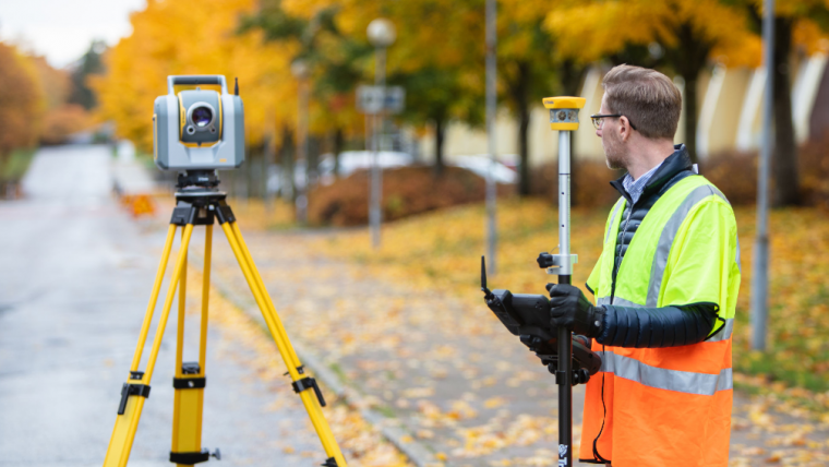
The changing role of the surveyor
Unwavering integrity in an increasingly complex digital continuum
Although the essence of surveying has barely changed since the profession began, the increasingly complex digital continuum requires geospatial professionals to adapt their skills in dynamic and important ways, writes Chris Trevillian.
Deeply rooted in the complex history of human progress, the geospatial profession has played an essential role in the underpinnings of equitable and efficient land delineation and infrastructure development over millennia. The essential nature of the surveyor – to provide integrity in the mapping and representation of the physical world and to physically deliver design information back to the surface of our Earth – is largely unchanged since the beginnings of our profession.
However, the demands of today’s world are asking us to adapt our skills in dynamic and important ways. The complexity of our projects continues to grow, while the requests to improve efficiency resound louder than ever. It is up to us to embrace the changing tools as they become available and expand the integrity of information exchange across a wider swath of industry stakeholders.
Actionable, assured intel
Not that long ago, our profession required large survey parties and significant amounts of time and skill to analyse measurements and convert them into detailed maps and actionable information. Today, many projects require professional licensed surveyors to deploy in distinct phases: early phase to feed the design, middle phase for design translation/layout, and late stage for validation to ensure the quality of the built infrastructure.
Today’s advanced geospatial instrumentation allows for complex physical measurements of radio signals from space, or from light signals reflected off nearby prisms or surfaces, to be instantly digitized and seamlessly integrated with other information sources to paint a more comprehensive, near-real-time view of the world. Instrument sophistication continues to move toward higher levels of traceability, improving overall data quality by systematically eliminating random measurement errors and ensuring data integrity at the point of capture.
Unlocking more of the potential
We are finally unlocking more of the potential from solutions such as mobile Lidar and aerial photogrammetry (which generate massive amounts of data in short periods of time) by incorporating new machine learning techniques that help surveyors automatically extract highly detailed information out of these complex datasets. It is truly incredible how quickly massive amounts of data can be processed and analysed by the geospatial professional in today’s world. This is an important macro trend at a time in history when many in our profession around the world are struggling to retain quality talent. These changes are allowing the survey professional to focus less effort on data quality assurance and more on the underlying information integrity for project stakeholders.
As these physical data capture techniques and digital modelling capabilities skyrocket in sophistication and reliability, we are also seeing the plan, design and build continuum become increasingly digitized at a faster pace. Paper plans are seen less frequently, and high-paced design changes with seamless data interoperability are becoming a requirement across large development projects to ensure project efficiency. We are starting to see large ‘paperless’ infrastructure projects come to completion – and this will be more the rule rather than the exception not too long from now.
Accountability
The need for accountability to project, governmental and societal stakeholders is growing, as society is increasingly concerned with the unnecessary waste and the resulting negative environmental impact of projects. In these increasingly complex physical-to-digital and digital-to-physical transformations, there is no space for errors or project rework. The surveyor’s role must transcend the data capture/process/analyse model. It must move towards a comprehensive, high-integrity, real-time 4D project model that will expedite accountability and critical decision-making while accurately documenting project progress and design changes throughout the entire lifecycle.
Adaptability
As we move towards the future, surveyors must continue to adapt to the increasing speed of innovation and market dynamics. As products, platforms and processes continue to evolve, so too must our workflows. Instead of moving people and data from one place to another, we’ll need to learn to move information – and thus decisions – more quickly. Recent advancements in artificial intelligence (AI) and machine learning (ML) rightfully receive a lot of media attention, and the geospatial profession will eventually apply these techniques to field capture systems, including geospatial Internet of Things (IoT) sensors that enable a more dynamic and real-time view of the digital construction process. These same technologies will undoubtedly enhance workflows and continue to eliminate user errors, further streamlining our professional efficiencies.
Artificial intelligence
I believe that AI will be a critical enabler at the seam of physical-to-digital transformation across the myriad industries that surveyors serve. Just imagine a network of autonomous geospatial IoT sensors processing data on the edge and feeding real-time clash detection information identified by ML/AI back to project stakeholders, only to have a construction AI toolset redesign the building information modelling (BIM) on the fly based on lowest rework cost and project timeline impact. I honestly believe this reality is closer than most of us realize.
For our future’s most complex projects to deliver on time and under budget, the surveyor’s expertise in quality assurance will need to infiltrate all aspects of the construction continuum. That infiltration will occur not only in discrete data types or project steps, but will integrate deeply into the real-time models and measurement systems required to dynamically map the changing environment during a project lifecycle. Our essence hasn’t changed, yet our professionals will be asked to evolve from geospatial data managers into geospatial information managers who translate our physical reality into a high-integrity and dynamic digital representation of that reality across a much broader range of stakeholders.

Value staying current with geomatics?
Stay on the map with our expertly curated newsletters.
We provide educational insights, industry updates, and inspiring stories to help you learn, grow, and reach your full potential in your field. Don't miss out - subscribe today and ensure you're always informed, educated, and inspired.
Choose your newsletter(s)


