Uruguay Updates National Imagery to Support Sustainable Development
The last complete aerial photography collection effort in Uruguay was conducted in 1966‒1967 to produce a national dataset at 1:50,000 scale. Only parts of the country have been captured since that time. In 2015, recognizing the multiple benefits of updated cartographic information to support future development, the Uruguay government, through the IDEUy (Infraestructura de datos espaciales de Uruguay), initiated a project to map the nation. Based on a thorough evaluation of the alternatives, including aerial photography, Lidar and satellite imagery, the IDEUy chose aerial digital cameras as the best technology to update the Uruguayan geographic dataset.
(this article is brought to you by Vexcel)
Project Attracted International Interest
This multi-million-dollar mapping project attracted the interest of aerial companies from all around the globe – Europe, North America and South America. Many companies visited Uruguay and presented their solutions to meet the specifications of the tender.
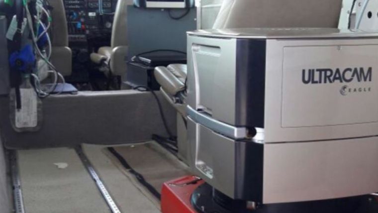
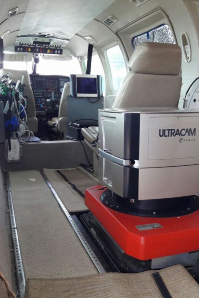
Ten foreign companies eventually submitted bids, and in early 2017 Topocart, an experienced Brazilian company, was announced the winner. Topocart presented the most attractive proposal incorporating the leading equipment at that time – the Vexcel Imaging UltraCam Eagle Mark 2, which offered a pan frame image footprint of more than 23,000 pixels across the flight strip and an exchangeable lens system.
“The excellence of the UltraCam Eagle M2 technology was fundamental for the success of the Uruguay project,” says Givanildo Silva, Technical Director, Topocart. “Not only the hardware components, but also the UltraMap processing software suite, which delivers a highly automated workflow with the capacity of generating true orthophotos, one of the most important requirements for the project. We worked closely with GeoToolBox Ibérica, Vexcel Imaging’s Latin American representative, to configure the most effective photogrammetric solution.”
Topocart had already successfully completed a similar project flying the entire state of Sao Paulo in Brazil, an area almost the same size as Uruguay. The company’s experience, proximity and the state-of-the-art equipment it offered for the project contributed to Topocart’s selection as the winner of the tender.
Meeting the Strict Specifications
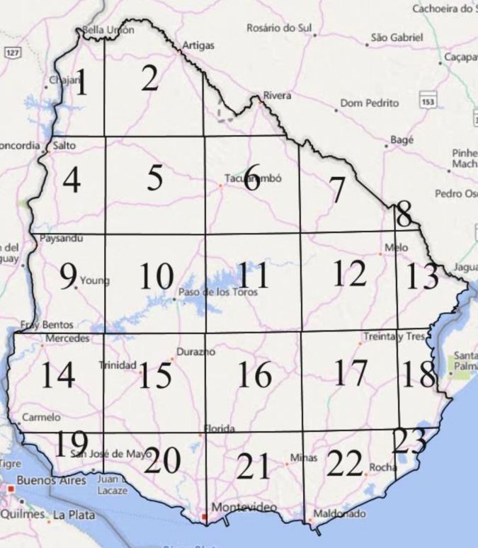
The project was divided into two subprojects: the first to capture the whole country at 32cm GSD and the second to acquire 10cm resolution imagery of the main population centers throughout Uruguay.
To meet the specifications, Topocart proposed the following:
- National flight (178,000km2)
- GSD of 32cm
- Accuracy in XY, better than 1m
- Accuracy in Z, better than 1.5m
- Urban flight (1,298 km2)
- GSD of 10cm
- Accuracy in XY, better than 0.2m
- Accuracy in Z, better than 0.3m
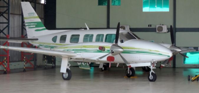
With the UltraCam Eagle Mark 2, it is necessary to fly at around 24,000ft to capture 32cm GSD and at 7,500ft to achieve 10cm. Topocart primarily used a Carajá aircraft, and the camera was installed with a gyro stabilization mount.
Along with the camera, Topocart combined the use of an Applanix GNSS system with ground control points (GCP) to achieve the requested accuracy. Only about 600 GCP were required for the whole country, which demonstrates the advantage of combining a quality IMU system with a high-performance photogrammetric camera.
In addition to the images, the following deliverables were produced:
- National flight
- DTM of 2.5x2.5m
- Ortho Images based on DTM in RGB and NIR
- Urban flight (80 population centers)
- DTM of 1.0x1.0m
- Ortho Images based on DTM in RGB and NIR
- True Ortho Images based on DSM in RGB and NIR
The project began in January 2017 and the last orthoimages were finished in June 2019 – it took approximately 2.5 years to acquire imagery and deliver all the products.
Primary Project Challenges
As with most aerial photography projects, a major challenge was the weather. Some areas of Uruguay were constantly cloudy, so it was necessary to wait for weeks, or even months, for clear skies to capture cloud-free images.
The volume of data also had an impact on the project. In total, around 30,000 images were collected for the National coverage at 32cm GSD, which meant many flight hours as well as many processing hours. It was crucial to have a software capable of handling huge amounts of data efficiently. Vexcel Imaging’s UltraMap software was selected for the job.
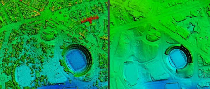
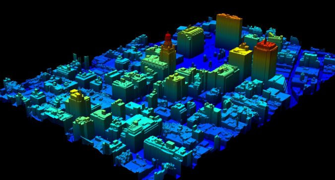
Also, establishing a cost-effective process for creating True Ortho images based on the DSM requires pre-planning to collect the necessary data. In this case, the project was flown using a high overlap in urban areas and the data were processed with UltraMap software. The results exceeded IDEUy’s expectations and provided Uruguay with True Orthophotos of urban areas at 10cm, something not available yet in other big cities in the region.
For the IDEUy, a major challenge was quality control and how to ensure all the specifications were being met. Several experts from different external organizations were hired for the project. They focused on several aspects, such as accuracy of the flights and identification of well-defined ground control points. Additionally, the True orthophotos were checked for shadows and hotspots. Overall, the resulting deliverables were very high quality.
A Dataset for Many Applications
The updated nationwide digital dataset includes cartographic maps at 1:2,000 scale – a major improvement over the 1:50,000 scale maps produced in the 1960s. Other deliverables provide useful information about population centers, contours, hydrography, and boundaries, and the locations of roads, schools, police stations, tourist attractions, and hospitals are clearly marked.
A geoportal is being developed to make this information accessible online to the public and government agencies. Many areas of government, such as urban planning, forestry, defence, agriculture, environmental protection, infrastructure, disaster response, agriculture, etc., will benefit. The Uruguayan government is committed to sustainable development throughout their country, and the improved geographic information supports its efforts.
“This nationwide digital dataset is extremely valuable to Uruguayan government agencies tasked with planning and completing all types of infrastructure projects,” says Dr Diego Pastorin, President of IDEUy’s board of directors. “We consider this project to be an important step in our country’s future development.”
About Topocart
Based in Brasilia, Brazil, Topocart provides worldwide services in infrastructure engineering, urban planning, environmental studies, mapping, aerial photogrammetry, geoprocessing, and surveying and geodesy. The company has been operating Vexcel Imaging UltraCam digital photogrammetric aerial systems since 2008. It currently owns an UltraCamLp and an UltraCam Eagle Mark 2.
About GeoToolBox Iberica (GTBi)
GTBi has been providing photogrammetry solutions to clients throughout Spain, Portugal and Latin America for more than 25 years. The company seeks out the best and the latest technology to create custom hardware and software packages to meet specific needs.

Value staying current with geomatics?
Stay on the map with our expertly curated newsletters.
We provide educational insights, industry updates, and inspiring stories to help you learn, grow, and reach your full potential in your field. Don't miss out - subscribe today and ensure you're always informed, educated, and inspired.
Choose your newsletter(s)


