3D Target Adds 3 Velodyne Lidar Sensors to its Range
This article was originally published in Geomatics World.
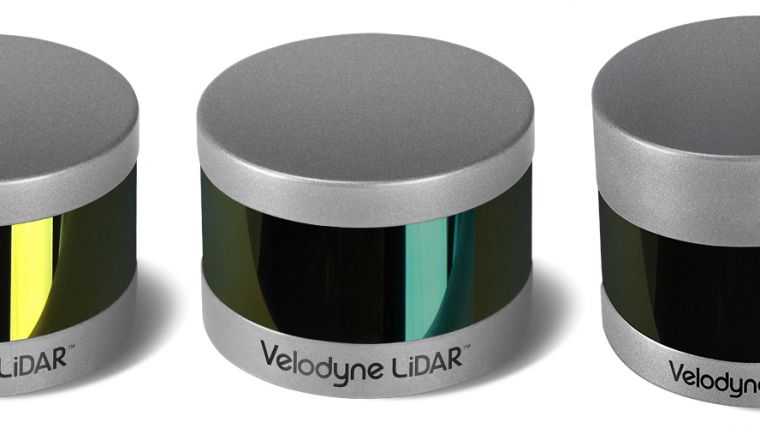
3D Target and Velodyne are expanding their relationship with the integration of Velodyne’s Puck LITE VLP-16, Puck Hi-Res VLP-16 and ULTRA Puck VLP-32C Lidar sensors into the growing Scanfly product line. This 3D Target product range provides a reliable turnkey Lidar system for demanding geospatial applications across air, land and marine platforms.
While the product was initially developed for the UAS market, it is designed to be used in any deployment platform, said Paolo Girardi, 3D Target’s CEO. Taking this approach drove them to simplify the user experience without sacrificing system performance. By working with Velodyne Lidar, the company provides an ultra-compact, lightweight solution that can be deployed on any aerial, land or marine vehicle, as well as delivered in a backpack option.
Surveying all landscapes
From the start, 3D Target set out to build a payload Lidar that was planned in every detail to allow easy access, even for non-expert users, and be ready to be deployed in only five minutes. Scanfly was designed to be multi-platform to allow installation on any vehicle and can be configured to address the uniqueness of any landscape to survey.
For 3D mapping capabilities, 3D Target turned to Velodyne Lidar sensors, which deliver the most accurate real-time 3D data on the market. The result was a product that meets the requirements of research institutes, universities, design firms, large companies, surveyors and public administration.
Scanfly combines real-time GPS and GLONASS positioning and onboard instrument measurements so that it always returns geo-referenced data. In aerial deployments, Velodyne Lidar technology and the double return of the scanner allow the system to discriminate treetops from undergrowth, automatically obtaining accurate measurements. Also, the multiple profiles of the scanner strongly reduce shaded areas which can speed up the mapping of roads and landscapes.
Details of the Lidar sensors
Scanfly Ultra weighs 1.85kg and its 32-channel sensor has a range of up to 200m. The sensor retains the innovative breakthroughs in 3D Lidar such as 360° surround view along with real-time 3D data that includes distance and calibrated reflectivity measurements along with rotational angles. It generates up to 600,000 measurements per second in single return mode.
Scanfly Lite, which weighs 1.5kg and addresses application demands that require lower weight. It includes Puck LITE VLP-16, a 16-channel, real-time 3D Lidar sensor with 360° surround view and a 100m range. The sensor generates up to 300,000 measurements per second in single return mode.
Scanfly HD, which weighs 1.8kg and includes a 16-channel, real-time 3D Lidar sensor, which generates up to 300,000 measurements per second in single return mode. It is designed for applications that require greater resolution in the captured 3D image. The device includes Puck Hi-Res VLP-16, which has a 360° surround view and 100m range. It delivers a 20° vertical field of vision for a tighter channel distribution to provide greater details in the 3D image at longer ranges. The sensor enables the host system to not only detect, but also better discern, objects at greater distances.

Value staying current with geomatics?
Stay on the map with our expertly curated newsletters.
We provide educational insights, industry updates, and inspiring stories to help you learn, grow, and reach your full potential in your field. Don't miss out - subscribe today and ensure you're always informed, educated, and inspired.
Choose your newsletter(s)


