Airborne Photogrammetric Platform
MGGP Aero has realised a new Airborne Photogrammetric Platform, being an integration of the Cessna T206H NAV III with the LiteMapper 6800i. Aircraft made its maiden flight across the Atlantic Ocean. The route of flight was 9908 km and took 41 hours with many stopovers. The plane was brought from Denver in the US, where he underwent photogrammetric modification.
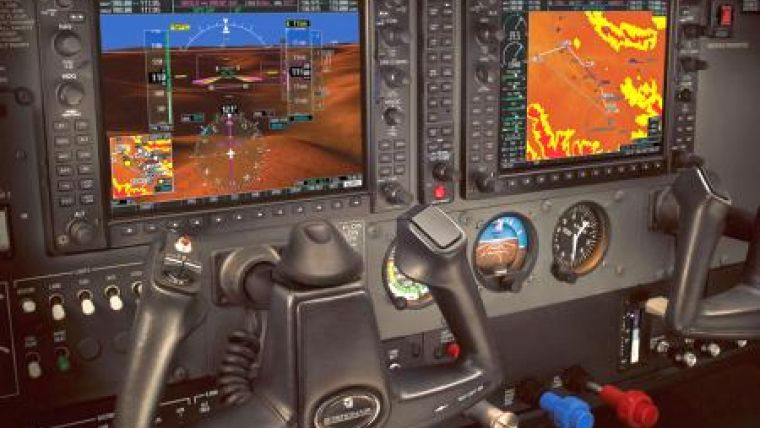
Cessna known as the Stationair a family of single engine, general aviation aircraft with fixed landing gear used in commercial air service, aerial photography and also personal use. Cessna T206H is certified as a six seat aircraft equipped with "glass" cockpit and Garmin G100 as an integrated flight instrument system typically composed of two units, one serving as a primary flight display, and one as a multifunctional display.
Aircraft is equipped with the latest system LiteMapper 6800i. This is a RIEGL LMS-Q680i airborne laser scanner with a laser pulse repetition rate of 400kHz, providing an effective measurement rate of up to 266,000 coordinates per second.
Successful tests confirmed that the system is achieving the expected quality and accuracy. The technology has been used in several projects: flood recovery efforts, environmental analysis, archaeological research, engineering projects and surveying.
New Airborne Photogrammetric Platform became authorised by Civil Aviation Office and is recorded in MGGP Aero's AWC (Aerial Work Certificate).

Value staying current with geomatics?
Stay on the map with our expertly curated newsletters.
We provide educational insights, industry updates, and inspiring stories to help you learn, grow, and reach your full potential in your field. Don't miss out - subscribe today and ensure you're always informed, educated, and inspired.
Choose your newsletter(s)


