Australian State to Conduct Ambitious Lidar Survey Project
The Digital Twin Victoria (DTV) Program is investing over AU$4 million in new Lidar surveys across the Australian state of Victoria to support a range of land and infrastructure management activities. These activities include site investigations, flood mapping, vegetation mapping, surface modelling, cultural heritage mapping and land surface change detection.
The DTV Program is a four-year historic initiative running to 2024 that will harness digital innovation, emerging technologies and geospatial data to unlock economy-wide savings through Victoria’s Big Build and leverage the digital acceleration underway in response to COVID-19.
Commencing in 2022 and due for completion in 2023, this project under the DTV Program will be the largest-ever Lidar survey conducted by the Victorian Government. The survey will provide the high-quality elevation data needed by digital twins for accurate 3D visualization and analysis.
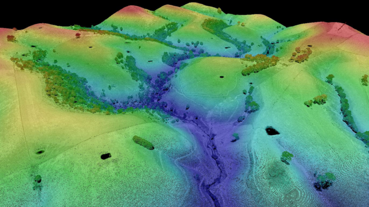
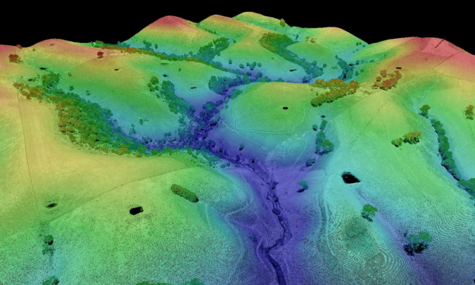
State-wide High-resolution Digital Elevation Model
Lidar surveys – whether from aerial or mobile platforms – provide accurate, high-resolution data about the physical form of the ground and the features on it. The data can be used to produce other datasets such as Digital Elevation Models (DEMs), or to extract specific objects and features of interest such as individual trees in a forest or individual buildings within the built environment.
This data will also enable DELWP to produce Victoria's first state-wide high resolution digital elevation model (DEM), the Vicmap 1M DEM, which will be a 100x improvement on the existing Vicmap 10M DEM. Additionally, this Lidar project will contribute detailed forest models, support ecological analysis, guide bushfire preparation and recovery and inform climate change responses over the coming decades. Vegetation models will extend to urban forests, contributing valuable information around street trees and providing information for urban greening projects.
Underpinning Surface for 3D Models
To conduct this survey, elevation experts in Vicmap and the Coordinated Imagery Program are working with suppliers AAM, Aerometrex, and Fugro to complete the surveys by early 2023. Quality assurance will be provided by the Coordinated Imagery Program before the Digital Elevation Models (DEMs) are loaded into the DTV platform for viewing and for use as the underpinning surface on which 3D models are placed within the Twin.
The Lidar survey is controlled using the state’s Survey Control Network, with coordination of a significant number of new survey marks contributed by the Office of the Surveyor-General Victoria. The contribution to the project by the Surveyor-Generals Office is pivotal to achieving the desired quality, including the high level of vertical accuracy.
The dataset will enable new and innovative uses of Lidar including automated feature extraction of buildings and trees, 3D modelling and rooftop analyses for thermal and solar.
Public sector users can access this data by joining the Coordinated Imagery Program (CIP). Private sector users and citizens will be able to access this data through our data resellers.

Value staying current with geomatics?
Stay on the map with our expertly curated newsletters.
We provide educational insights, industry updates, and inspiring stories to help you learn, grow, and reach your full potential in your field. Don't miss out - subscribe today and ensure you're always informed, educated, and inspired.
Choose your newsletter(s)


