Automatic Point-cloud Generation and 3D Modelling from Aerial Images
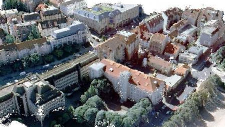
Fully automated generation of very dense 3D point clouds and Digital Surface Models (DSM) from stereo aerial images (nadir and oblique) is rapidly gaining ground. The most efficient method is to use Semi Global Matching (SGM) algorithms. Tridicon PointCloud GTA produces accurate point clouds for 3D analysis as well as textured digital surface models from imagery collected in flight missions by aeroplanes, helicopters or unmanned aerial vehicles or from satellite imagery or terrestrial photography collected by mobile mapping vehicles.
tridicon BuildingFinder uses these high-quality DSM for object recognition and 3D reconstruction. The automatic production of building footprints and 3D building models in LOD 2 will revolutionise data capture for regions where cadaster data are not available yet. Soon the tridicon BuildingFinder will replace the tridicion 3D CityModeller which still uses given 2D vector data like building footprints to automatically produce 3D building models.
GTA's software solutions also include the photogrammetric workstation tridicon 3D EDITOR for quality management of automatically produced 3D building models and editing as well as modules for automatic texturing from aerial imagery (tridicon TextureMapper), automatic solar potential assessment (tridicon SOLAR) and 3D real-time visualisation and analysis (tridicon CityDiscoverer).

Value staying current with geomatics?
Stay on the map with our expertly curated newsletters.
We provide educational insights, industry updates, and inspiring stories to help you learn, grow, and reach your full potential in your field. Don't miss out - subscribe today and ensure you're always informed, educated, and inspired.
Choose your newsletter(s)


