Bentley Systems Acquires Aarhus GeoSoftware
The Seequent business unit of Bentley Systems has acquired Danish company Aarhus GeoSoftware, a developer of geophysical software. The acquisition extends Seequent’s solutions for operational ground water management, and for sustainability projects involving exploration, contaminants and infrastructure resilience.
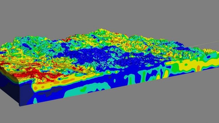
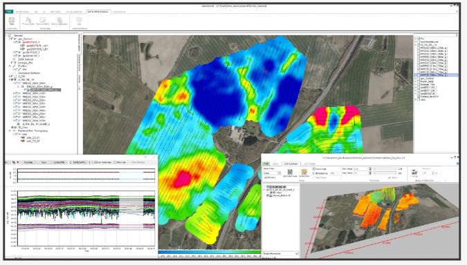
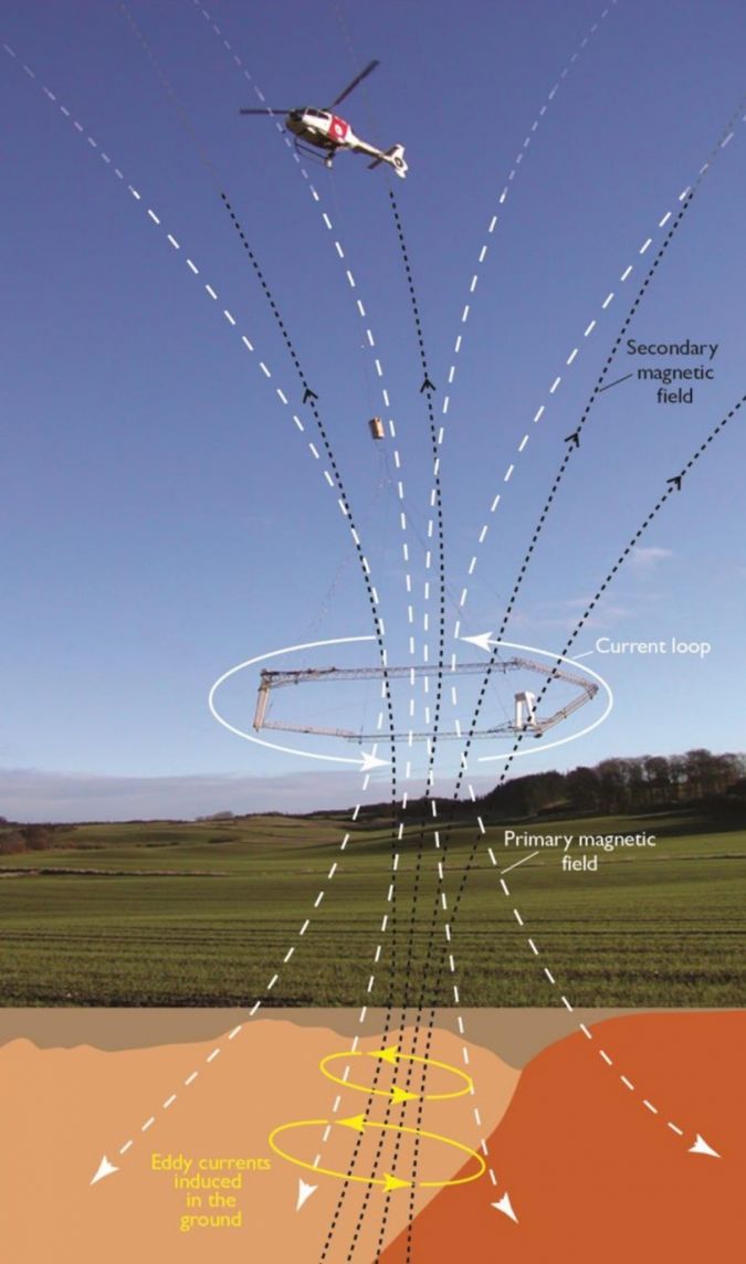
Aarhus GeoSoftware, a spinoff company from Aarhus University in Denmark, develops the software packages AGS Workbench, SPIA, Res2DInv, and Res3DInv for the processing, inversion, and visualization of geophysical data from ground-based and airborne electromagnetic (EM), electrical resistivity tomography (ERT) remote sensing, and other sources. AGS software enables users to create 2D and 3D images of subsurface electrical resistivity. The outputs of the software can be used to distinguish and differentiate subsurface materials and can subsequently be modeled in Seequent’s Leapfrog to aid in various subsurface investigations.
Electric field measurements
The software uses electric field measurements, collected at ground level or with airborne sensors, to map the subsurface distribution of certain materials such as water, mineral deposits, and clays. Electrical resistivity allows a better understanding of the distribution of materials such as water, mineral deposits, and clays, and when the water contains other compounds such as salt, researchers and industry professionals can infer the distribution.
The genesis of AGS software was to ensure clean drinking water for future generations by mapping groundwater across Denmark. It is now used in many different areas, including locating subsurface faults and cavities to mitigate construction risk, in mining for investigating orebodies and waste rock and tailing processes, monitoring movements of groundwater and contaminants to help understand environmental impacts, modelling dam and tunnel stability, and assessing landslide risk to gauge asset resilience or construction plan impacts. Seequent will continue its tradition of collaborating with universities and research organizations worldwide through ongoing engagement with Aarhus University for the development of AGS geophysical solutions.
Graham Grant, chief executive officer of Seequent, explained: “The acquisition will add new geophysical data processing capabilities to our workflows to help advance subsurface investigation and modeling. AGS software, coupled with Seequent’s advanced geologic modeling and analysis software, creates a key tool in helping understand and manage groundwater and assessing risk in infrastructure such as dams and canals. We’re excited about the new possibilities this opens up for our collective users worldwide, improving life-time digital twins.”
Toke Højbjerg Søltoft, chief executive officer of Aarhus GeoSoftware, said: “Seequent’s global reach will allow AGS software to positively impact more projects worldwide. As we continue to develop solutions, our users will benefit from our tools being in Seequent’s ecosystem and workflow. We’re excited to join Seequent and to work together on our shared vision of helping organizations make more informed and sustainable decisions through a better understanding of the subsurface.”
For more information, see here.

Value staying current with geomatics?
Stay on the map with our expertly curated newsletters.
We provide educational insights, industry updates, and inspiring stories to help you learn, grow, and reach your full potential in your field. Don't miss out - subscribe today and ensure you're always informed, educated, and inspired.
Choose your newsletter(s)


