BLOM Maps Red-mud Disaster Area in Hungary
BLOM, together with Hungarian remote-sensing company ENVIROSENSE, has performed laser scanning and hyperspectral mapping of areas affected by red-mud leakage from the broken dam in North-Western Hungary.
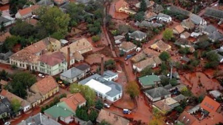
On 4th October 2010, the embankment of the red mud reservoir failed and released a mixture of 600-700 thousand cubic metres of red mud and water. Lower parts of the settlements of Kolontár, Devecser and Somlóvásárhely villages were flooded. Nine people died, and another 120 people were injured. The red mud flooded 800 hectares of surrounding areas. The most severe devastation was caused in the villages of Devecser and Kolontár, which are located near the reservoir. The disaster is one of the worst environmental catastrophes in Hungarian history.
Areas around Kolontár, Almasfuzito and Mosonmagyarovar were mapped by Blom using hyperspectral and Lidar (laser scanning) sensors. Acquired data will be used for emergency management, modelling of potential scenarios and for detection of possible future damages to the dams. The collected data will be analyzed by experts from the University in Gyöngyös and national Emergency Directorate in Hungary.

Value staying current with geomatics?
Stay on the map with our expertly curated newsletters.
We provide educational insights, industry updates, and inspiring stories to help you learn, grow, and reach your full potential in your field. Don't miss out - subscribe today and ensure you're always informed, educated, and inspired.
Choose your newsletter(s)


