Bluesky and Ecopia team up for high-precision Ireland map
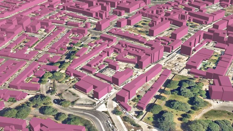
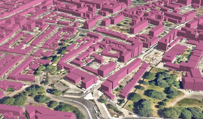
Bluesky International and Ecopia AI have formed a partnership to develop a 3D land cover map of Ireland. The map will be generated using Bluesky's high-resolution aerial imagery (12.5cm and 25cm) and Ecopia's AI-based mapping systems, ensuring it is accurate, comprehensive and up to date. The map is expected to provide significant benefits to both public and private-sector organizations operating in Ireland.
This collaboration enables to provide organizations with highly detailed map data, offering a reliable source of truth for land cover across Ireland. The resulting 3D land cover map boasts high-precision vector layers that capture a wide range of features, from buildings, roads, pavements and bridges to parks, car parks, sports grounds, forests and lakes.
Adding value from highly detailed aerial imagery
Together, both companies will update this data annually to ensure the map stays up to date with a rapidly changing world. This fresh and accurate map data will inform decision-making across industries, spanning use cases including urban planning, stormwater management, telecommunications network expansion and more.
“At Bluesky, innovation is at the heart of everything we do and this partnership with Ecopia, a leader in AI-based mapping, will enable us to help our clients derive additional value from our high-resolution aerial imagery in a new and exciting way,” said Rachel Tidmarsh, CEO at Bluesky. “Ecopia’s AI algorithms generate accurate and detailed mapping and this partnership will enable us to drive innovation that meets the rising demand for this high-quality geospatial information.”
“Ecopia is excited to partner with Bluesky to bring our 3D mapping capabilities to Ireland,” said Abigail Coholic, senior director of partnerships at Ecopia. “The nationwide 3D map of Ireland is a great example of how geospatial companies can work together to provide critical insights to both the public and private sectors, and we are proud to work with long-time market leader Bluesky to deliver this unprecedented level of detail to our customers.”

Value staying current with geomatics?
Stay on the map with our expertly curated newsletters.
We provide educational insights, industry updates, and inspiring stories to help you learn, grow, and reach your full potential in your field. Don't miss out - subscribe today and ensure you're always informed, educated, and inspired.
Choose your newsletter(s)


