Boosting wildfire preparedness with UP42 and OroraTech's sensor tasking
UP42 and OroraTech have signed a partnership agreement to grant easy and fast access to global high-resolution thermal-infrared imagery. UP42 is a geospatial developer platform and marketplace, and OroraTech is a leader in space-based thermal intelligence and low-latency, global-coverage, near-real-time thermal data products.
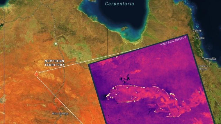
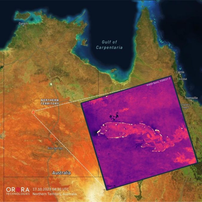
OroraTech is a pioneering addition to UP42's expanding marketplace comprising nearly 80 data and processing partners. OroraTech delivers invaluable insights to clients during unpredictable events using its latest thermal sensor, FOREST-2. Through UP42’s marketplace, the company provides the following data products: on-demand tasking for near-real-time data access worldwide, offering 400km coverage with 200m resolution on a daily basis. Additionally, users gain access to an ever-expanding archive of thermal imagery, facilitating in-depth analysis of past events.
UP42 tasking allows for advanced capabilities such as order tracking, automated delivery and support for complex and multi-geometry AOIs. Furthermore, OroraTech's tasked data is managed in UP42's STAC-compatible storage, simplifying the search and management of data for easier processing and integrations.
Thermal-infrared data
"As global temperatures rise, wildfires and heatwaves are having an increasing impact on people, the environment and economies. In 2022 alone, heat waves accounted for 99% of all climate-related deaths in Europe," said Sean Wiid, CEO of UP42, referring to a recent World Meteorological Organization report. "Expanding our offering with OroraTech’s thermal-infrared data will help our customers build early-warning and monitoring systems to help us mitigate the impact of these climate-related emergencies."
OroraTech's high-resolution thermal data serves customers on six continents, ranging from forestry and utility companies to governmental organizations and geospatial experts. Facilitating rapid disaster response, location accuracy and predictive analytics, its data helps assess risks and minimize losses, and supports 24/7 response measures. "With UP42, our customers have easy and quick access to our thermal tasking capability," stated Axel Roenneke, CCO at OroraTech. "This partnership accelerates our route to the geospatial market."
To learn more about and order OroraTech’s thermal-infrared products, feel free to visit UP42’s marketplace for on-demand tasking and the marketplace for the archive of thermal imagery.

Value staying current with geomatics?
Stay on the map with our expertly curated newsletters.
We provide educational insights, industry updates, and inspiring stories to help you learn, grow, and reach your full potential in your field. Don't miss out - subscribe today and ensure you're always informed, educated, and inspired.
Choose your newsletter(s)


