Canada Commits Millions for Ecopia AI to Support Net Zero Initiatives
Ecopia AI has entered a CAD8 million dollar funding partnership with Sustainable Development Technology Canada, which will support the creation of high-precision 3D vector maps across the top 100 cities in Canada. This next-generation digital mapping data will support sustainability related initiatives as part of the Canadian Government’s plan to achieve net zero emissions by 2050.
Digital maps serve as the foundation for many applications that help to facilitate economic growth, community development and climate resilience. However, Canada has historically operated without a high-precision, uniform digital representation of its cities – the creation of such a map offers an opportunity to increase the efficiency and accuracy of decision-making within cities and across the nation – with applications spanning government, insurance, telecommunications, transportation and public safety.
By creating a digital representation of the top 100 cities in Canada, this initiative will support municipal stakeholders to better understand and manage their cities – including the acceleration of net zero initiatives such as rooftop solar installations, tree canopy coverage assessment and enhanced flood mapping. These standardized maps will also enable provincial and federal stakeholders to better understand and benchmark progress toward net zero 2050 targets – offering valuable insight for policy and funding programmes.
AI-based Mapping Systems to Mine Aerial Imagery
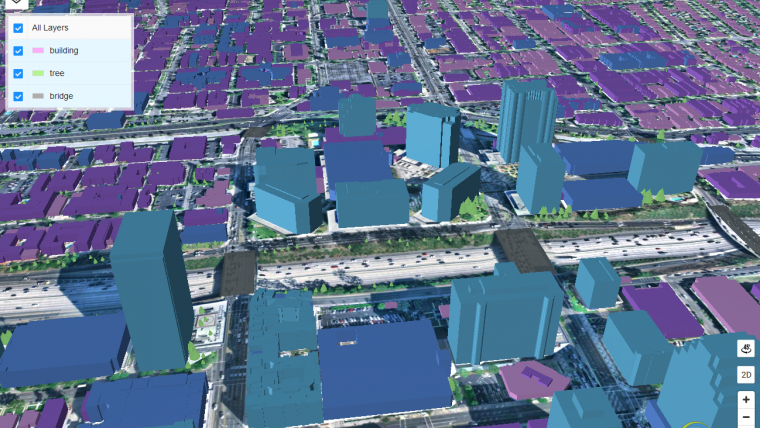
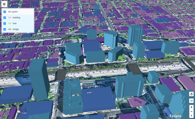
Ecopia will leverage its AI-based mapping systems to mine high-resolution multi-view aerial imagery, producing the high-precision 3D vector map of the top 100 cities. The resulting map will offer a highly accurate digital representation of every building, road, bridge, railway, driveway, pavement, parking lot, swimming pool, sports field, waterbody, forest, grassland, bare land and paved area across each city. The cities of Thunder Bay and Windsor are consortium partners on the project and will be at the forefront of deploying these maps for sustainability related applications. In addition, Ecopia will be offering each of the top 100 municipalities across Canada a two-year licence to the data to help support immediate action toward the climate resilience initiative.
“Canadians across the country are part of the solution in fighting the climate crisis and Ecopia is seizing the moment and doing their part. Our government knows that when investments in science, technology and innovation are paired with ambitious and talented Canadian entrepreneurs, it drives the breakthroughs we need to fuel a more resilient and sustainable future for everyone,” stated François-Philippe Champagne, Minister of Innovation, Science and Industry.
“Big data plays a vital role in achieving and maintaining optimum environmental sustainability. With this funding, SDTC is proud to help Ecopia optimize their data solution, paving the way for bigger market opportunities and greater sustainability,” said Leah Lawrence, president and CEO of SDTC.
“We’re excited and honoured to be leading the creation of this high-precision 3D map of Canadian cities. This initiative will create the foundation of a digital twin for cities across the country – providing data that will help support smart, safe, sustainable communities,” Jon Lipinski, president and co-founder of Ecopia AI, stated.

Value staying current with geomatics?
Stay on the map with our expertly curated newsletters.
We provide educational insights, industry updates, and inspiring stories to help you learn, grow, and reach your full potential in your field. Don't miss out - subscribe today and ensure you're always informed, educated, and inspired.
Choose your newsletter(s)


