Central role for TatukGIS in Topoflight’s aerial survey missions
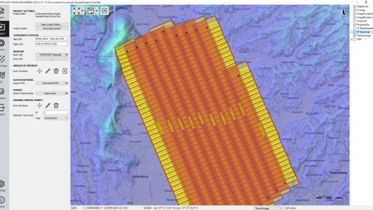
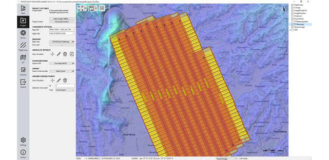
The TatukGIS Developer Kernel (DK) plays a key role in the Topoflight software suite (Missionplanner for optimal flight paths, and Navigator for precise data acquisition). In the realm of vast aerial surveys, precision is key. Equipped with cutting-edge technology, Topoflight utilizes helicopters and aircraft to capture high-resolution images and employ Lidar for surface scanning. TatukGIS has been an indispensable component of the Topoflight suite of aerial mapping software for the visualization of geospatial information for more than two decades.
Aerial surveys of medium to very large areas are undertaken utilizing helicopters and aeroplanes. At altitudes ranging from hundreds to thousands of metres, high-resolution images of the Earth’s surface are captured (photogrammetry) or a laser is employed to scan the surface to generate a cloud of data points (Lidar technology). To meet the high demands and satisfy specific requirements, such as achieving desired ground pixel size across a terrain while minimizing flight time, meticulous planning of flight missions is imperative. The Topoflight suite of aerial mapping software products conquers this challenge.
Complex calculations
Topoflight Missionplanner is tailored for the complex calculations of optimal flight dispositions in three-dimensional space. Topoflight Navigator comes into play during the data acquisition. Navigator enables pilots to navigate precisely along the calculated flight lines and, furthermore, ensures that carried sensors trigger at exactly the right times.
For the past two decades, the TatukGIS Developer Kernel (DK) has been an indispensable component of the Topoflight software suite. Missionplanner and Navigator both employ TatukGIS for the visualization of geospatial information. Navigator even integrates TatukGIS in its real-time, onboard flight navigation system, where efficient computing is essential.
Addressing geospatial challenges
TatukGIS is a trusted solution for addressing numerous geospatial challenges. Ongoing development at TatukGIS is shared with customers via regular DK version releases, enabling continuous enhancement of Topoflight products. The TatukGIS support desk plays a significant role in this process by offering excellent assistance and incorporating customer input for improvements. As a recent example, when the Topoflight team needed a specific real-time ‘smooth map rotation’ feature, TatukGIS performed this small custom development in a short space of time and added it as an option in the DK, enabling Topoflight to incorporate the desired behaviour into its products.
Topoflight is used by many companies all over the world to measure and visualize the Earth’s surface in projects of all sizes. For more information about Topoflight products, see here.
To learn more about the TatukGIS development libraries, see here.

Value staying current with geomatics?
Stay on the map with our expertly curated newsletters.
We provide educational insights, industry updates, and inspiring stories to help you learn, grow, and reach your full potential in your field. Don't miss out - subscribe today and ensure you're always informed, educated, and inspired.
Choose your newsletter(s)


