CHCNav introduces AlphaUni 20 Lidar system
The AlphaUni 20 (AU20) Lidar system represents a new era in cost-effective, multi-platform mobile mapping solutions, according to CHC Navigation (CHCNav), a global leader in precision mapping, positioning and navigation technologies. Harnessing the power of six years of innovation and product development fuelled by CHCNav’s Lidar technology, the AU20 is aimed at redefining mobile mapping and democratizing the reality capture industry by making it accessible to all.
“We are thrilled to unveil the AlphaUni 20, a versatile and powerful Lidar system that sets new standards in the industry,” said Andrei Gorb, product manager at CHC Navigation. “The AU20’s advanced features and exceptional accuracy open up a world of possibilities for surveying and mapping professionals, streamlining workflows and providing unmatched precision.”
Redefining precision for critical applications
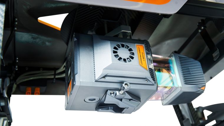
With an absolute accuracy of 2 to 5cm, the AlphaUni 20 offers a reliable and precise 3D reality capture solution for a wide range of demanding applications. The AU20’s advanced multi-target capability supports up to 16 target echoes to penetrate vegetation. It captures ground surfaces with extreme precision, producing accurate digital elevation models (DEMs) and digital surface models (DSMs) in extremely challenging environments.
The lightweight, compact design of the AU20 has resulted in a mobile mapping solution that weighs only 2.82kg in its airborne configuration and a total of only 10.7kg with its car mount kit, including a Ladybug5+. Thanks to the flexible multi-platform design, the AU20 is particularly versatile. Users can install it on crewed or uncrewed aircraft for aerial scanning, seamlessly integrate it into a variety of land vehicles, and even use it as a backpack-mounted system for mapping narrow areas.
Live demos
Live demonstrations at Intergeo 2023 will enable survey professionals to witness first-hand the AU20’s accuracy and versatility. During the leading geospatial industry event in Berlin, potential users will have the chance to see the system in action, capturing detailed geospatial data for a variety of applications, from road surfaces to asset management and beyond.
As part of the company’s mission to democratize the reality capture industry, CHCNav is actively seeking potential partners to help bring the AlphaUni 20 to new markets. Interested parties are invited to become part of the global network of authorized partners and access a full range of support and opportunities to expand their business.


Value staying current with geomatics?
Stay on the map with our expertly curated newsletters.
We provide educational insights, industry updates, and inspiring stories to help you learn, grow, and reach your full potential in your field. Don't miss out - subscribe today and ensure you're always informed, educated, and inspired.
Choose your newsletter(s)


