Cloud-based GIS System for Agricultural Resource Management
New technologies and government policies are both in favour of maximising food production. The movement for sustainable agriculture is also significantly increasing in order to maintain a balance between environmental health and economic profitability. GIS technologies are giving the Council of Agriculture in Taiwan the ability to establish a cloud-based agricultural information system for easy access to GIS resources and support the nation’s sustainable agriculture.
The Council of Agriculture, Taiwan, has launched a scheme named 'Agriculture Cloud Service Project' that focuses on the improvement of agriculture cloud services and the establishment of a large database of agricultural information to support the nation’s sustainable agriculture.
On the basis of the project, Taiwan's Agricultural Research Institute, Council of Agriculture, set up the cloud service for agricultural production area management to substantially integrate and share agricultural information about weather, soil conditions, fertiliser use, insect pest early warning and natural disasters, as well as relevant workflows.
The development of agricultural information application and integration system ensures that all the data on agriculture cloud database can be integrated into map through GIS geoprocessing technologies, to classify, store, and manage geospatial data in a cloud database according to Common Land Unit (CLU) for improving data accuracy of digital agriculture information management.
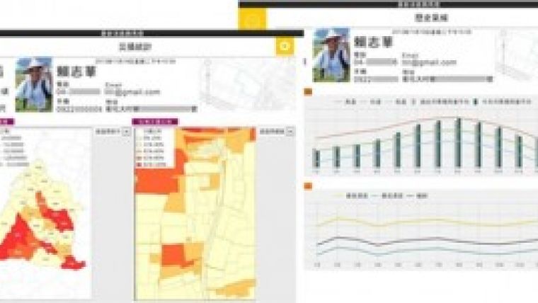
In addition, the system allows agricultural specialists, tillage managers, and farmers to quickly query agricultural and geospatial information of records of climate change, weather forecasts, water resources, soil, geology, topography and disaster prevention for better planning.
SuperGIS
Built on SuperGIS Server, the agricultural information application and integration system combines with various knowledge bases and decision support databases to display agriculture-related information such as map, statistical diagrams, and visualised charts for helping policy makers devise practical agriculture plans. Moreover, the system supports the connection with the websites of other government departments like Weather Bureau, Ministry of Transportation, etc., offering a more convenient way to access related information.
Due to the development of agricultural information application and integration system, both the agricultural experts and the officials can effectively query agricultural-related information according to different spatial categories and consequently provide farmers with real-time agricultural information based on each city or county and proper suggestions for fertiliser use or insecticides use.

Value staying current with geomatics?
Stay on the map with our expertly curated newsletters.
We provide educational insights, industry updates, and inspiring stories to help you learn, grow, and reach your full potential in your field. Don't miss out - subscribe today and ensure you're always informed, educated, and inspired.
Choose your newsletter(s)


