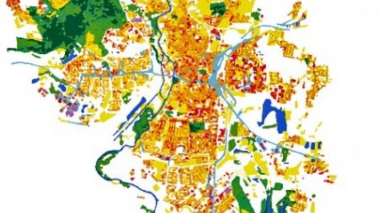
Clutter Data Set for Germany
GAF AG has reached the mid-term milestone for the production of a national land use and land cover data set. The raster data product will be available in summer 2009. Land use and land cover data are useful for many business and research applications. They enable regional planning activities, the set-up and management of mobile telecommunication networks and facilitate environmental mapping and monitoring.
At present only very few and outdated data sets matching high quality customer criteria are readily available. GAF had decided in early 2009 to launch the production of "EURO-MAPS LC", based on recent, multi-spectral IRS P6 LISS-III satellite data sets dating mostly from 2007/2008. An object-oriented production chain and fully quality controlled, interactive mapping procedures are combined to create a homogeneous product, featuring 22 object classes with a minimum mapping unit of 0,25ha and a minimum 90% accuracy in each object class. The data set will be marketed using a staggered license model adapted to corporates and public authorities.
Euro-Maps LC is the fruit of 20 years workflow development and an accumulated experience of 2 mllion km² mapping at 1:50.000 and 1:25.000 scales. In combination with a high-positional accuracy EURO-MAPS LC can be utilised for many purposes either as stand-alone product or in combination with other data like e.g. Euro-Maps 2D and Euro-Maps 3D.

Value staying current with geomatics?
Stay on the map with our expertly curated newsletters.
We provide educational insights, industry updates, and inspiring stories to help you learn, grow, and reach your full potential in your field. Don't miss out - subscribe today and ensure you're always informed, educated, and inspired.
Choose your newsletter(s)


