Cyclone Pam Satellite Imagery: Before and After
Following Cyclone Pam, Airbus Defence and Space has acquired Pléiades and SPOT 6 & 7 imagery over the island nation of Vanuatu to support the International Charter and Copernicus Emergency Management Service. The data acquired will assist in assessing the damage and help rescue organisations in the delivery of humanitarian aid.
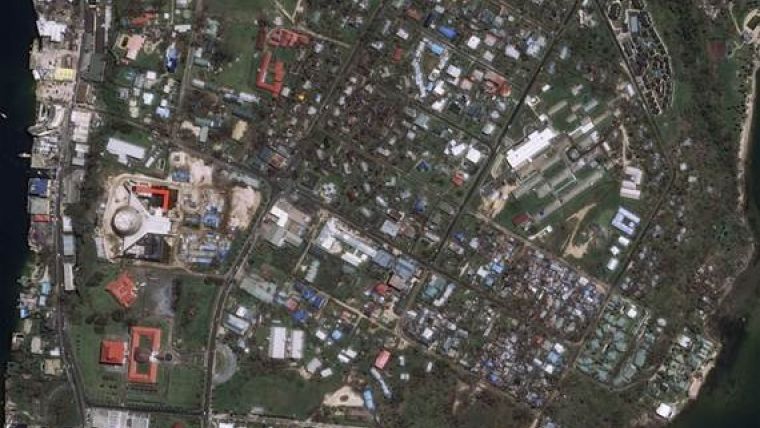
The 'before and after' Pléiades images over Port Vila, which can be downloaded here, show the devastation caused by the cyclone. The 'before' Pléiades image was acquired on 9 April 2014, and the 'after' Pléiades image was acquired on 16 March 2015, three days after the cyclone hit Port Vila.

Value staying current with geomatics?
Stay on the map with our expertly curated newsletters.
We provide educational insights, industry updates, and inspiring stories to help you learn, grow, and reach your full potential in your field. Don't miss out - subscribe today and ensure you're always informed, educated, and inspired.
Choose your newsletter(s)


