EUSI integrates Pixxel's hyperspectral data for enhanced imaging
European Space Imaging (EUSI) has recently have announced a strategic partnership giving users direct access to the world's most detailed hyperspectral imagery from Pixxel. Combined with EUSI’s capability to build insights and products, the partnership is poised to set a new benchmark in remote sensing applications in the region. EUSI is a leading provider of very high resolution (VHR) satellite imagery, and Pixxel is a leader in pioneering hyperspectral earth-imaging technology.
The ever-expanding offering from EUSI solidifies its position as a hub for EO data in the region. With this collaboration, customers can now acquire Pixxel’s hyperspectral dataset in addition to world-leading optical and SAR imagery, all from one single source.
Bringing hyperspectral data benefits to the market
“High-quality hyperspectral imagery has been an elusive dataset within the Earth observation community, and therefore, the opportunities to drastically impact industries across the globe are yet to be realized,” said Adrian Zevenbergen, CEO of European Space Imaging. “Pixxel’s innovative technology is filling this gap and EUSI is proud to partner with them to help bring the benefits of hyperspectral data to the market and demonstrate our commitment to Europe’s agriculture and energy production goals through the use of remote sensing.”
“We are thrilled to partner with EUSI to realize Pixxel’s vision of building a health monitor for the planet,” said Awais Ahmed, co-founder and CEO of Pixxel. “EUSI’s confidence in our technology and their rock solid reputation and track record will be instrumental in helping us expand our footprint across Europe and North Africa.”
Education and adoption
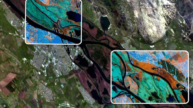
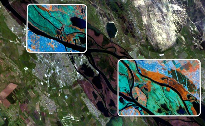
Capturing upto 250 bands at 5m resolution with daily revisit, the sophisticated features of Pixxel's sensors power meaningful change detection across the agriculture, forestry, energy and mining sectors. The sensor characteristics combined with flexible tasking and a highly tunable band set selection are what will distinguish Pixxel’s offering for EUSI customers.
“We are keen to collaborate with EUSI’s in-house geospatial experts and their deep network of resellers across the EU to catalyse the education and adoption of hyperspectral data,” said Aakash Parekh, chief commercial officer, Pixxel. “Hyperspectral is particularly valuable in its ability to identify species, detect greenhouse gas emissions and measure above-ground biomass and we look forward to bringing these solutions to EU enterprises and governments through this partnership.”
Pixxel has raised US$71 million to date and has 50+ early adopter customers globally. With three hyperspectral satellites already in space, Pixxel is now working towards launching six satellites in 2024 and 18 further satellites by 2025, aiming to build a comprehensive health monitor for the planet.

Value staying current with geomatics?
Stay on the map with our expertly curated newsletters.
We provide educational insights, industry updates, and inspiring stories to help you learn, grow, and reach your full potential in your field. Don't miss out - subscribe today and ensure you're always informed, educated, and inspired.
Choose your newsletter(s)


