
First Step Towards Land and Cadastral Reform in Lebanon
A major project reform in Lebanon at the cadastre and land register department level has started with the support and cooperation of the French development agency and the expertise of France, via the FEXTE project that funds technical cooperation programmes and project-preparation studies in developing countries.
Despite the current situation given the COVID-19 pandemic, the Order of Surveyors and Topographers of Lebanon insists on monitoring its activities within the general framework of the profession, especially at the level of national and international partnership.
Following on from the initiative of the Director General of Land Affairs, Dr Georges Maarawi, in terms of the regulation of labour relations between the public and private sectors, this ambitious cooperation officially started in April 2021. The FEXTE project is managed by Expertise France, and financed by the French Development Agency, currently working alongside the DGAF in support of the modernization of the land and cadastral administration in Lebanon, supports this operation.
Roadmap towards cadastral reform in Lebanon
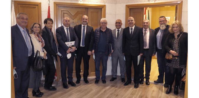
Upstream, a series of meetings and working sessions took place at the headquarters of the General Directorate of Land Affairs and at the headquarters of the Order of Certified Surveyors and Topographers of Lebanon with the Expertise France team, dedicated to this project. Innovative proposals and in-depth research have been developed dealing with the issue of public-private partnership, in particular the subject of cadastral reform in Lebanon at the technical, administrative, financial and legal level.
During this period, a number of recognized French experts intervened in the field and cooperated jointly with officials of the DGAF, the team of the Order of topographers and the FEXTE team to establish a roadmap presenting all aspects of the challenge and the necessary means to achieve it.
Yaacoub Saadé, director of researches and international relations, presented the order's vision of public-private partnership and stressed the importance of modernizing the cadastral system in Lebanon. President Boutros thanked the participants and wished this project every success, highlighting the professionalism and availability of the members of his Order, as well as their commitments in the service of the public interest.
The need for synchronized roles
Dr Maarawi emphasized the need for public-private partnership, a desire of caretaker Finance Minister Ghazi Wazni, as an opportunity to stimulate economic and social development in Lebanon and restore confidence to investors. This determination allowed tangible preparations such as the drafting of an agreement aimed at synchronizing the roles between the order of topographers, the two orders of engineers and the General Directorate of Land Affairs. Mr Touzet said he was impressed by the progress of the joint work, showing great professionalism and efficiency.
President Boutros gave the participants a tour of the order's premises and described how it works. At the close of the event, he presented distinctions on behalf of the Order to Dr Maarawi, and Mr Khalil, in gratitude and appreciation for their efforts in the service of the national interest. Mr Touzet also received a distinction, on behalf of the French State, as a token of thanks in particular, to the economic service of the French Embassy represented by Mr de Ricolfis, head of department, Mr Velud, financial advisor and to members of the FEXTE team.
Social contract
A series of reforms must be tackled, as the World Bank concluded in 2018: "Improving the clarity over land and property rights will be important to prevent land‐related conflicts from exacerbating other conflict dynamics and for improving the investment climate and access to credit. Similarly, increased access to reliable geospatial data will boost innovation, business development, job creation and growth, and informed decision-making, and enhancing the revenue base and local governance. An accountable and transparent land administration and geospatial system will improve the management of public assets including natural resources leading to a stronger social contract and trust between citizens and the government."
This article is based on a news release by FIG.

Value staying current with geomatics?
Stay on the map with our expertly curated newsletters.
We provide educational insights, industry updates, and inspiring stories to help you learn, grow, and reach your full potential in your field. Don't miss out - subscribe today and ensure you're always informed, educated, and inspired.
Choose your newsletter(s)


