GeoSLAM Launches New Underground Mining Solutions
UK-based geospatial mapping specialist, GeoSLAM, has expanded its mining offering, building on its world-leading reputation in the sector to provide advanced underground mining solutions.
The news follows the unveiling of its automated processing platform, GeoSLAM Connect, which provides users with the flexibility to process their data to their exact specifications through a series of interactive customisable script-based workflows. Many features of Connect are particularly useful for the mining sector, including the automatic georeferencing.
Change-detection and real-time decisions
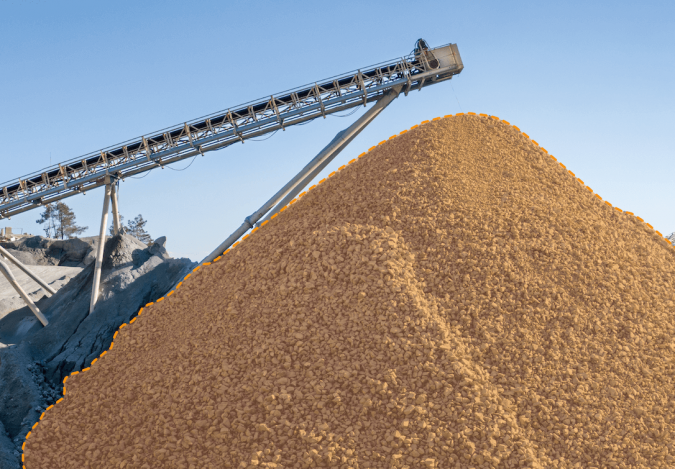
Underpinned by the software, and backed by the company’s expertise in the mining sector, the new innovations include production progress mapping, convergence analysis and vertical mine shaft inspection monitoring – all of which will sit alongside the existing solutions already available and in-use across the globe, including GeoSLAM Volumes for stockpile volumetric calculations.
Building on its well-established reputation within mining, the first of its new applications is GeoSLAM Production Progress Mapping – which, when coupled with a ZEB scanner and its own internal co-ordinate system, allows operators the flexibility to make short-term operational decisions on newly-mined production areas in quick time in a ‘mining-to-plan’ process.
Once the data from each scan has been automatically processed and georeferenced using GeoSLAM Connect, it can be uploaded to any compatible third-party software. Operators will be able to overlap collected data and precisely visualize changes of an area over time to compare with project plans – giving mine owners the freedom to analyze, make real-time decisions and avoid production hold-ups.
SLAM technology
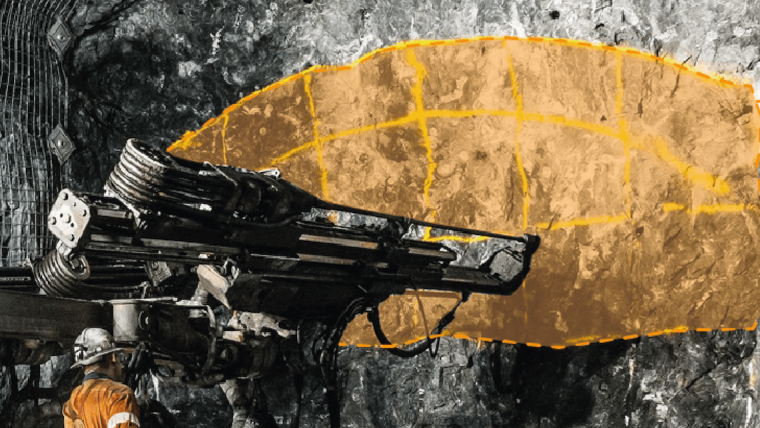
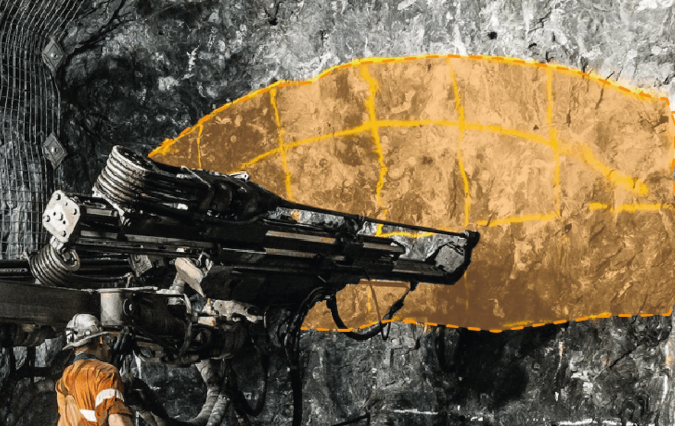
Mining has long been viewed as a hazardous occupation, but digital technologies like GeoSLAM’s new Convergence Analysis however, are reshaping this outlook by providing mine owners with a rapid and cost-effective way to understand the environment while keeping miners safe.
Utilizing GeoSLAM’s SLAM (simultaneous localization and mapping) algorithm to create clear 3D visualizations, mine operators will be able to quickly measure rock support – including detecting failure points, the velocity of change, potential slope and areas of displacement - all while remaining at a safe distance, and without the need to disrupt crews, due to the speed of capture.
Completing the trio is the purpose-built shaft inspection cradle, built for collecting data during inspections and analyzing change. From above ground, it allows users to understand the erosion of a shaft wall, view blockages and identify hanging points for ore in hard-to-reach and dangerous vertical shafts.
Issued as standard with each ZEB sale, its support package, GeoSLAM Care, offers mining customers unlimited access to hardware and remote software support, the latest software releases and access to GeoSLAM Academy; a portal of resources for customers to use including user training, videos and best practice information.

Value staying current with geomatics?
Stay on the map with our expertly curated newsletters.
We provide educational insights, industry updates, and inspiring stories to help you learn, grow, and reach your full potential in your field. Don't miss out - subscribe today and ensure you're always informed, educated, and inspired.
Choose your newsletter(s)


