Geospatial Excellence Award 2011
SuperGeo Technologies, the leading global provider of complete GIS software and solutions, is honoured to announce that it has won Geospatial Excellence Award by means of the application "Taipei City Advanced Traveler Information System (ATIS) Web", published using SuperWebGIS.
The award is held by GIS Development, one of the most reputed geospatial communications network companies in the world. During Geospatial World Forum 2011 in Hyderabad, India, SuperGeo will be given the "Geospatial Excellence Award" in "Transport Management" Category during the Awards Night (18th January 2011) at Geospatial World Forum.
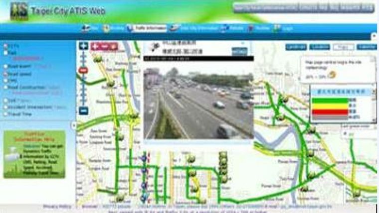
The project was authorized by Taipei City Government, which provides many kinds of traffic information, such as subway services, parking lots, road speeds, and CCTV, from many sectors. SuperGeo Technologies developed a WebGIS application integrating rich traffic data from dissimilar resources on the same platform. The GIS Web can display complex traffic data for all the public in real time conveniently.
The application used SuperWebGIS, the Internet map server software developed by SuperGeo Technologies, as the user interface platform. Organizations can deliver dynamic maps and share geospatial data via the Web promptly by the software. The WebGIS application has demonstrated how GIS technologies can help the management combine diversified types of real-time traffic information in one platform easily.

Value staying current with geomatics?
Stay on the map with our expertly curated newsletters.
We provide educational insights, industry updates, and inspiring stories to help you learn, grow, and reach your full potential in your field. Don't miss out - subscribe today and ensure you're always informed, educated, and inspired.
Choose your newsletter(s)


