Geospatial pioneer celebrates anniversary with mobile mapping solution launch
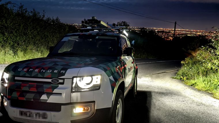
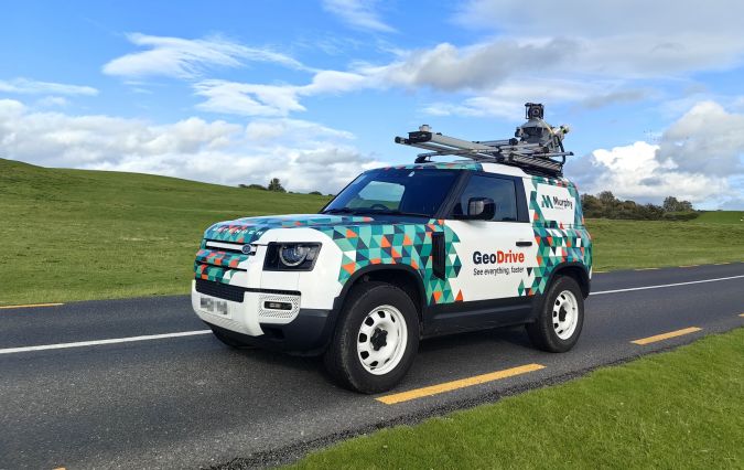
Celebrating four decades as a pioneering force in the UK and Ireland's geospatial industry, Murphy Geospatial has unveiled its innovative mobile-mapping solution called GeoDrive. This groundbreaking technology enables the collection of up to 100km of geospatial survey data daily, empowering clients with insights for data-driven decision-making in their projects.
Addressing the growing demand for swift and precise geospatial data within the built environment, the company has introduced its proprietary mobile-mapping technology. The eye-catching GeoDrive vehicle effortlessly acquires 100km of geospatial survey data within a single day. In a world where sustainability and infrastructure maintenance are paramount, Murphy Geospatial provides unparalleled accuracy, equipping asset owners with the knowledge they need for informed decisions, safeguarding long-term resilience and efficacy.
Tailored for large-scale endeavours in construction, infrastructure, energy and utilities, this service excels in efficiently collecting substantial data across expansive geographic regions, offering cost-effective advantages over traditional data collection methods.
High-precision scanners and a multi-camera system
The GeoDrive mapping solution uses high-precision scanners and a multi-camera system to collect sub-centimetre accuracy information and is mounted on top of a uniquely branded vehicle. Alternatively, it can be fixed to trains or other moving vehicles. The extremely precise data captured by this new service is also thanks to Murphy Geospatial's emphasis on quality control of workflows, managed by well-trained staff with their own expertise in geomatics, allowing them to focus on even the most trivial details of a project.
Maciej Targosz, associate director of Murphy Geospatial, commented: “This new solution is going to make a huge difference to clients gathering information in relation to large-scale projects. The speed at which GeoDrive can capture data will save clients both time and money when compared with the method of taking a total station along the length of a site.”
“GeoDrive also supports cost-effectiveness of projects as it means more detailed methods of surveying are deployed where they are needed, having already gathered base data for a project's entirety. This supports informed decision-making and optimized resource allocation.”
“For clients managing projects that cover highways, it will additionally eliminate the need for traffic management. GeoDrive will also help clients mitigate project delays, public inquiries, protests and production bottlenecks. We're looking forward to helping clients to access and analyse the quality data that GeoDrive can gather at speed, and will be offering this new service throughout Ireland, the UK and Europe,” Targosz added.


Value staying current with geomatics?
Stay on the map with our expertly curated newsletters.
We provide educational insights, industry updates, and inspiring stories to help you learn, grow, and reach your full potential in your field. Don't miss out - subscribe today and ensure you're always informed, educated, and inspired.
Choose your newsletter(s)


