GIS to Better Target Aid
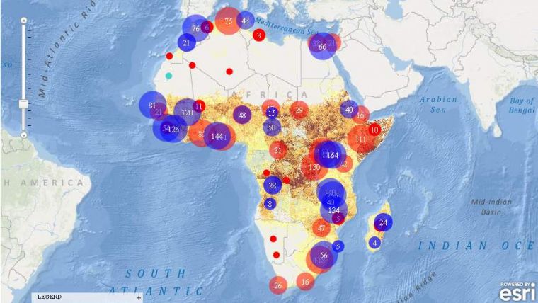
The Strauss Center's Climate Change and African Political Stability (CCAPS, TX, USA) programme has implemented Esri technology to view how climate change impacts vulnerable populations in Africa. CCAPS created the dynamic mapping tool in partnership with AidData for use by researchers, policy makers, journalists and citizens. Users can visualise any combination of CCAPS data on climate change, conflict and aid on a map to discover how different forces overlap or intersect.
The tool is already being used in the country of Malawi for a solution that tracks and reports on the country's external funding. Aid information is mapped along with data on climate change vulnerability and incidents of conflict. This sheds light on whether aid is effectively targeting regions where climate change or conflict poses the most significant risk to the sustainable development and political stability of the country.
By integrating CCAPS research on climate change, along with existing datasets such as topographic maps, imagery, and thematic information on conflicts, the CCAPS mapping tool aims to provide the most comprehensive view possible of climate change and security in Africa.
CCAPS and AidData will continue to release upgrades to the mapping tool throughout 2012. The current mapping tool is available to use now at www.strausscenter.org/ccaps/mappingtool. For more information on AidData, go to www.aiddata.org.

Value staying current with geomatics?
Stay on the map with our expertly curated newsletters.
We provide educational insights, industry updates, and inspiring stories to help you learn, grow, and reach your full potential in your field. Don't miss out - subscribe today and ensure you're always informed, educated, and inspired.
Choose your newsletter(s)


