GNSS Coordinate System for Ancient Harbour City
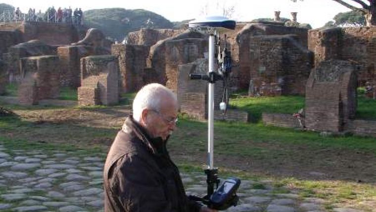
The ancient harbour of Ostia, a major Roman archaeological site in Italy, has been chosen by the superintendent of the archaeological heritage of Rome to receive a complete verification of all its former control points and a new GNSS-based coordinate system. The update, which began in March this year using the Ashtech ProMark 500 GNSS receiver, will contribute to efforts to manage and plan future archaeological studies at the site, noted for its preserved ancient buildings, beautiful frescos and mosaics.
Ostia was founded in 620 BCE as a military base to control the mouth of the Tiber river. Beginning in the 2nd century BCE, as Rome gained supremacy throughout the Mediterranean, the port grew to become the main emporium of Rome with many significant public and private buildings. Now located 4 kilometres (2.5 miles) inland from the shoreline, the 10 square kilometre (6.2 square mile) site is believed to remain rich in yet-to-be-discovered history.
The superintendent for the archaeological heritage of Rome selected the ProMark 500 survey system for its overall cost effectiveness, convenience and outstanding GNSS performance amid ruins and beneath vegetation.
The ProMark 500 receiver will be used to check and develop the existing network of control points and to extend the network further into the archaeological area. In addition, all points are being geo-referenced to the IGM - ETRF 2000's Reference Coordinate System. The project will also be included in a technical and scientific study about new survey techniques and technologies for the preservation of archaeological heritage to be presented to an upcoming congress of Italian universities and archaeological institutes. The project is lead by team manager Marco Sangiorgio, cartographer director coordinator, together with architects, Fabio Pandolfi, Stefano Stani and Aldo Marano.
Giorgio Viaggi and Luigino De Santis of Guido Veronesi S.a.s., a software developer and Ashtech dealer in Italy, assisted in developing the hardware and software solution, RTK survey techniques and data workflow procedures for the project.

Value staying current with geomatics?
Stay on the map with our expertly curated newsletters.
We provide educational insights, industry updates, and inspiring stories to help you learn, grow, and reach your full potential in your field. Don't miss out - subscribe today and ensure you're always informed, educated, and inspired.
Choose your newsletter(s)


