Highly Accurate Railway Mapping Project with TopoDrone UAV
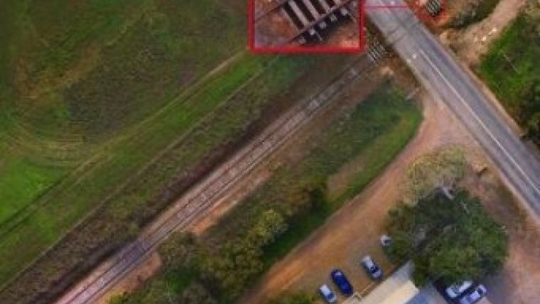
DroneMetrex has announced the successful completion of a high-precision railway mapping project in Australia. The company’s TopoDrone-100, which was developed in-house, flew over a crossing intersection of a railway and a bitumen road. It mapped 0.5km on each of the four sides of the approach to the crossing reliably and accurately. The UAV captured 2.5cm GSD aerial imagery with 25mm absolute accuracy in height.
DroneMetrex was able to achieve great results due to the fact that its TopoDrone-100 is a true photogrammetric mapping system which addresses geometric errors (tip, tilt, yaw, forward and lateral motion, blur) from the start and eliminates them right at the point of capturing the data.
The mapping project was aimed, in the first instance, at creating 3D “real world” for obscurity analysis when approaching an intersection from a train driver’s perspective, and from a vehicle driver’s perspective. Secondly, high accurate mapping was performed for future civil works involving repair as well as upgrading of the existing railway.
Traditionally such projects presuppose aerial photography, Lidar and corridor mapping from large manned aircrafts, which was not economically justified in this particular case, since the project area was quite small. At the same time, conventional ground surveying techniques were either inapplicable, as it would mean temporarily closure of the railway in order to observe all health and safety standards.
Tom Tadrowski, executive director of DroneMetrex, commented the whole process of data capture took only 2 hours and the TopoDrone-100 let them easily meet all the client’s requirements. The launches and landings happened from the nearby field. Therefore no interference with rail movements, no disturbance for road traffic ever occurred – in fact, they didn't even know DroneMetrex was there. This shows aerial mapping no longer needs to be time-consuming, no longer expensive and certainly should be readily available. Productivity has been significantly increased, and the same goes for data reliability.
The aerial photography was performed with 70% forward and 40% side overlap. Based on the captured data, DroneMetrex’s photogrammetrists produced very dense 3D point cloud, digital orthophotos and DTMs, as well as they performed 3D line mapping via photogrammetric 3D “heads-up” digitising. Mirahmad Chabok, development manager, said that the photogrammetry from their accurate TopoDrones makes it possible to match and produce a point cloud density of 1,600 points per square metre, i.e. 1 point per pixel.

Value staying current with geomatics?
Stay on the map with our expertly curated newsletters.
We provide educational insights, industry updates, and inspiring stories to help you learn, grow, and reach your full potential in your field. Don't miss out - subscribe today and ensure you're always informed, educated, and inspired.
Choose your newsletter(s)


