IBM and NASA launch major geospatial AI model on Hugging Face
IBM and the open-source AI platform Hugging Face are collaborating to make IBM's watsonx.ai geospatial foundation model accessible to the geospatial business professionals community. This model, developed from NASA's satellite data, is now openly available on Hugging Face's platform. Notably, this release marks the largest geospatial foundation model on Hugging Face and the first open-source AI foundation model developed in partnership with NASA.
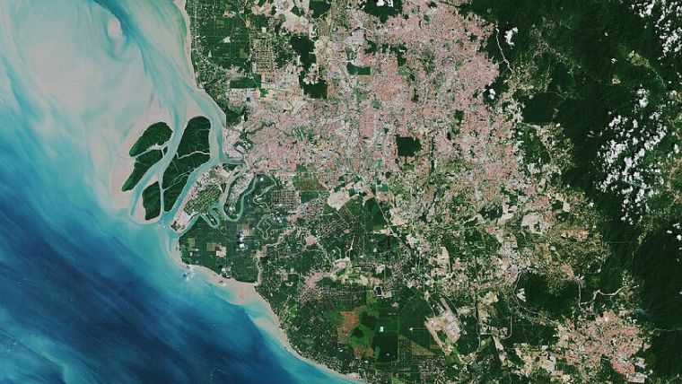
In the realm of climate science, the challenge of obtaining the latest data persists as environmental conditions undergo frequent changes. Despite the increasing volume of data available – NASA's estimates indicate that by 2024, scientists will have amassed 250,000 terabytes of data from new missions – researchers still grapple with hurdles when it comes to effectively analysing these extensive datasets. Earlier this year, IBM embarked on a mission, driven by a Space Act Agreement with NASA, to construct an AI foundation model for geospatial data. By releasing this geospatial foundation model on Hugging Face – a distinguished hub for open-source transformer models – efforts are being made to democratize access to AI and its applications, thereby fuelling innovative solutions in the fields of climate and Earth science.
The power of open-source AI
Open-source technologies are key in accelerating vital areas like climate change research. Combining adaptable AI systems from IBM with NASA's satellite data and accessible platforms like Hugging Face fosters collaborative solutions, benefiting the planet. The essence of AI is rooted in science and sharing information, as emphasized by Hugging Face's Head of Product and Growth. Open-source AI and shared models drive AI advancement, making benefits widely accessible. Foundation models, if open-sourced, could transform data analysis and enhance our understanding of the planet, as envisioned by NASA. This accessibility amplifies their impact and importance.
This model, a collaborative effort between IBM and NASA, underwent training using Harmonized Landsat Sentinel-2 satellite data (HLS) over the span of a year across the continental United States. Subsequent fine-tuning was performed using labeled data to enhance accuracy in flood and burn scar mapping. Impressively, the model has exhibited a 15% improvement over state-of-the-art techniques, utilizing only half the amount of labelled data. Through further refinement, the base model has the potential to be repurposed for various tasks, such as monitoring deforestation, projecting crop yields and detecting greenhouse gases. IBM and NASA researchers are also collaborating with Clark University to adapt the model for applications like time-series segmentation and similarity research.
2023 is the Year of Open Science
This endeavor aligns with IBM's prior announcement of collaborating with NASA to expedite the analysis of satellite images and drive scientific discovery. It contributes to NASA's decade-long Open-Source Science Initiative, which seeks to foster a community of science that is accessible, inclusive and collaborative. Aligned with this initiative, NASA, along with federal agencies and the White House, has designated 2023 as the Year of Open Science, celebrating the benefits derived from open sharing of data, information and knowledge.
The model capitalizes on IBM's foundation model technology and constitutes a broader effort to develop and train versatile AI models capable of addressing diverse tasks and transferring knowledge across scenarios. In July, IBM unveiled watsonx, an AI and data platform empowering enterprises to expand and accelerate the impact of advanced AI through reliable data. A commercial version of this geospatial model, integrated into IBM watsonx, is slated for release through the IBM Environmental Intelligence Suite (EIS) later this year.


Value staying current with geomatics?
Stay on the map with our expertly curated newsletters.
We provide educational insights, industry updates, and inspiring stories to help you learn, grow, and reach your full potential in your field. Don't miss out - subscribe today and ensure you're always informed, educated, and inspired.
Choose your newsletter(s)


