Icaros Releases Aerial Oblique Image Mapping System
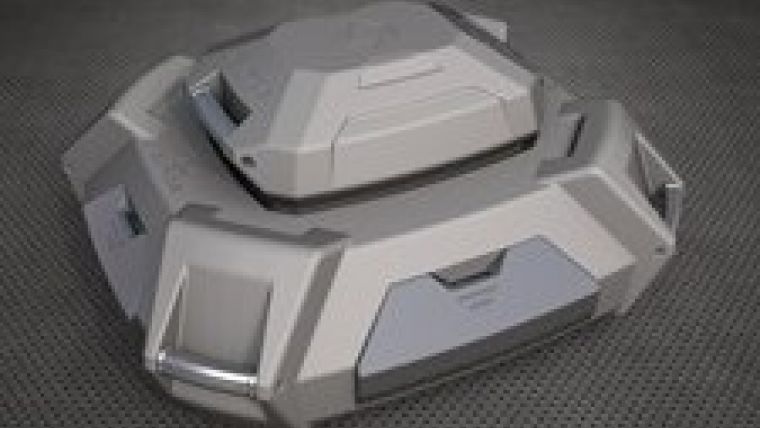
Icaros, a leading provider of advanced aerial remote sensing technology, has announced the release of its latest aerial remote sensing system, the Icaros Digital Mapper (IDM) 1000. The IDM 1000 combines the Icaros nadir, single-camera IDM 200 mapping system with an additional four oblique (45 degrees from nadir) cameras, designed for advanced analysis and 3D modelling application needs.
The IDM 1000 improves on other currently available oblique mapping systems through its hybrid camera design that combines an 80MP mapping nadir camera with 39MP visualisation oblique cameras. The modular design allows operators to use the 80MP nadir camera independently for RGB, NIR, and thermal imagery collection projects. Combined with Icaros’ advanced image processing software, Icaros Photogrammetric Suite (IPS), the Icaros oblique solution enables customers to produce high-quality, geometric and geospatially-accurate point clouds and 3D models from nadir and oblique imagery.
The IDM 1000 system enables customers to collect the high-quality mapping imagery they need, while adding state-of-the-art oblique capabilities for visualisation and 3D work, said Tom Bosanko, CEO at Icaros. He said his company is excited as a team to be able to provide a new, best-of-breed solution that maintains the high standards of Icaros’ remote sensing technologies in terms of quality, flexibility and ease of use.

Value staying current with geomatics?
Stay on the map with our expertly curated newsletters.
We provide educational insights, industry updates, and inspiring stories to help you learn, grow, and reach your full potential in your field. Don't miss out - subscribe today and ensure you're always informed, educated, and inspired.
Choose your newsletter(s)


