Inertial Labs and E38 collaborate for drone-Lidar integration
In a new strategic partnership, Inertial Labs' RESEPI Payload Lidar technology will be integrated into E38's advanced E455 drone platform. This collaboration marks a significant milestone in the utilization of uncrewed aerial systems (UAS) for professional surveying, mapping and inspection services. Inertial Labs is recognized for its innovative essential navigation solutions, and E38 Company is a prominent developer of premium drone solutions.
RESEPI (Remote Sensing Payload Instrument) is a sensor-fusion platform tailored for accuracy-focused remote sensing applications. It leverages a high-performance Inertial Labs INS (GPS-aided Inertial Navigation System) and a high-accuracy single or dual-antenna GNSS receiver integrated with a Linux-based processing core and data-logging software. The RESEPI Payload Lidar system will seamlessly integrate with the E455 drone, enhancing its capabilities to capture high-resolution, 3D spatial data across various environments. This integration aims to revolutionize industries such as construction, agriculture and environmental monitoring by offering unprecedented detail and accuracy.
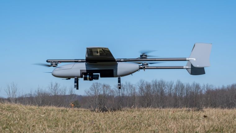
The E455 is an innovative fixed-wing vertical takeoff and landing (VTOL) UAS designed to operate on battery power with a maximum takeoff weight of up to 29.5kg. It features a removable payload bay with an open architecture at the centre of gravity, ensuring maximum utility and flexibility for various mission requirements. Capable of flying for over 2 hours or carrying payloads of almost 7kg, the E455 is an ideal platform for extensive surveying and mapping missions with the integrated RESEPI Payload Lidar system.
Gathering detailed topographic data
Jamie Marraccini, Inertial Labs CEO, stated: "By combining our advanced RESEPI Payload Lidar with E38's sophisticated E455 drone, we are setting a new standard for aerial surveying and mapping technology. This collaboration represents a leap forward in our mission to provide comprehensive, turnkey solutions that empower industries to achieve more."
Andrew Wilber, business development specialist for Event 38 Unmanned Systems, added, "The E455's unique VTOL capabilities, extended flight duration, and versatile payload capacity, combined with Inertial Labs' leading RESEPI Lidar technology, enhance our offering to the market. It provides our clients an unparalleled, accurate, efficient and safe data collection tool. We're proud to partner with Inertial Labs and excited for the opportunities this partnership opens up."
Combining the E455 drone's robust flight capabilities with the high-precision Lidar technology of the RESEPI payload will enable users to gather detailed topographic data in challenging terrains and under diverse conditions.

Value staying current with geomatics?
Stay on the map with our expertly curated newsletters.
We provide educational insights, industry updates, and inspiring stories to help you learn, grow, and reach your full potential in your field. Don't miss out - subscribe today and ensure you're always informed, educated, and inspired.
Choose your newsletter(s)


