INS for Airborne Mapping
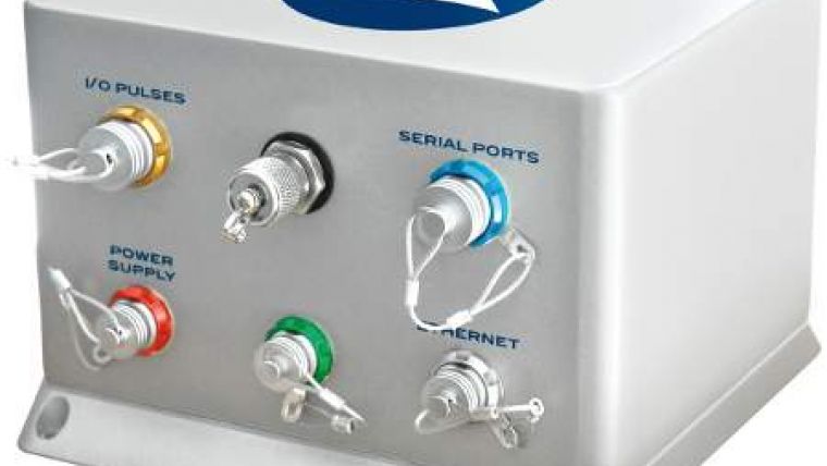
iXBlue, France, has presented ATLANS as a cost-effective georeferencing and orientation system, designed for land and airborne mapping applications. The user obtains a compact, lightweight gyrocompass and motion sensor that consumes little power and yet provides all of the required data for demanding navigation, stabilisation and control applications as in UAS, digital imaging and hyperspectral imaging applications.
ATLANS can be easily integrated with standard GNSS and DMI systems and is combined with most commonly used flight management, satellite tracking and mobile imaging systems. All of the interface and computing electronics are contained within a single housing that also features an embedded RTK GPS board for centimetre accuracy performance.
The new system is based on fiber optic gyroscope (FOG) technology, developed by iXBlue over a period of 25 years and incorporated into a range of high-performance positioning and navigational aids for use in civil, defence and space applications. Being solid-state and having no moving parts, FOGs have become renowned for their ruggedness and stability, and for their extended and maintenance-free service lives.
Benoit Kerouanton, product manager, considers the new gyroscope as an attractive option for users pursuing a range of UAV and Lidar mapping, digital imaging and hyperspectral imaging applications.

Value staying current with geomatics?
Stay on the map with our expertly curated newsletters.
We provide educational insights, industry updates, and inspiring stories to help you learn, grow, and reach your full potential in your field. Don't miss out - subscribe today and ensure you're always informed, educated, and inspired.
Choose your newsletter(s)


