Mapping altitudes in the Alpine region
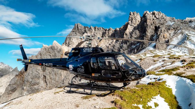
Gravitational acceleration measurements were conducted in the Allgäu region of southern Germany by the Federal Agency for Cartography and Geodesy (BKG) in September this year. In high-altitude locations, helicopters were utilized to access the measurement points. These measurements play a crucial role in enhancing altitude determination through satellite-based methods such as GNSS.
The elevations derived from satellite navigation systems such as GPS and Galileo cannot be directly applied to many practical scenarios, as they pertain to a geometrically defined reference surface. In contrast, everyday elevation references are based on a zero-level surface known as the mean sea level geoid, which has an irregular shape influenced by the Earth’s gravity field. To make use of GNSS measurements, a transformation model – known as a geoid model – is necessary (e.g. for the satellite positioning service SAPOS) to determine accurate altitudes.
Geoid model accuracy
With the continuous technological advancements in satellite methods and their expanding applications, such as in construction and avalanche protection, the demands for geoid model accuracy and reliability have heightened. In the Alps, the target accuracy of one centimetre has not been consistently attained across all areas. Achieving a precise geoid model necessitates various factors, including extensive measurements of gravitational acceleration to within a few kilometres. Notably, data gaps still persist, especially along the German-Austrian border.
In 2018, the BKG executed a similar campaign in the German Alps, albeit with a primary focus on the Berchtesgaden Alps. Further measurements are now planned for the Allgäu region, encompassing approximately 60 locations situated in challenging, hard-to-reach terrain. Some of these points are accessible by car or even on foot, whereas others lie close to the Austrian border and can only be reached via helicopter.
The campaign is receiving planning and execution support from the Agency for Digitization, High-Speed Internet and Surveying (LDBV) of the Free State of Bavaria and the Federal Office of Metrology and Surveying (BEV) in Austria. The endeavour takes into consideration environmental concerns and includes coordination with local conservation authorities and landowners.
This initiative also aligns with international cooperation efforts within the European Alps Geoid Project (EAlpG), which aims to establish an improved cross-border geoid model for the Alpine region. This collaboration serves the purpose of standardizing altitude systems between Germany and its neighbouring countries.
The measurement campaign in the Alpine region, particularly in the Karwendel Mountains, is anticipated to conclude by 2024.
The German Combined Geodetic Network (GCG) serves as the official height reference for Germany and is developed through a partnership between the BKG, the Working Committee of the Surveying Authorities of the states of the Federal Republic of Germany (AdV) and the Institute of Geodesy (IfE). The current version, GCG2016, is readily accessible in the BKG geodata centre free of charge.


Value staying current with geomatics?
Stay on the map with our expertly curated newsletters.
We provide educational insights, industry updates, and inspiring stories to help you learn, grow, and reach your full potential in your field. Don't miss out - subscribe today and ensure you're always informed, educated, and inspired.
Choose your newsletter(s)


