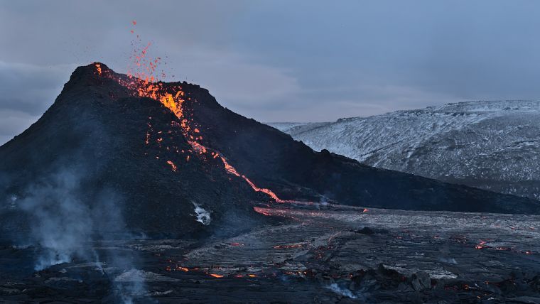
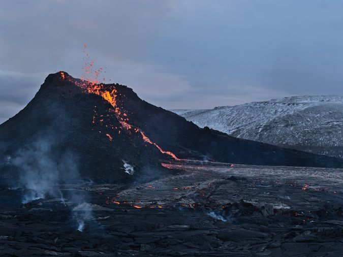
Mapping Iceland’s volcanic fury with Acecore’s high-end drones
The Icelandic authorities have commissioned Acecore to map the extent and aftermath of the Eldvörp-Svartsengi volcanic system eruption using its high-end drone solutions. Grindavík, a fishing village on the Reykjanes Peninsula in southwestern Iceland approximately 50km from Reykjavík, has been uninhabitable since residents were evacuated in November 2023 following a series of earthquakes. The question remains whether the residents of Grindavík will ever be able to return to their village.
“The drones that Acecore makes are particularly suitable for use under tough circumstances,” said Jorrit Linders, founder and CEO of Acecore, on the Dutch public-service radio station NPO Radio 1. “The drones can operate in severe weather conditions, such as wind force 7 or 8, temperatures well below zero, and hail and snow showers. This is due to the robust frame, the strong design and the right components. The robust construction is produced entirely in the Netherlands. This, combined with an impressive continuous flight time of 2.5 hours, is essential for projects such as the volcanic eruption in Iceland.”
Ground-penetrating radar
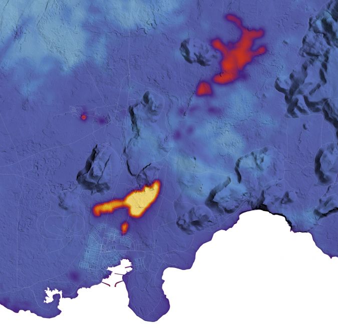
Acecore has been mapping in the region near Grindavík for several weeks now. Since the volcano is still very active, with earthquakes and eruptions still occurring, monitoring is done in close consultation with the Icelandic authorities and experts. The drone flights take off from fixed locations to perform their automated missions: scanning the affected area to collect all data needed by the Icelandic authorities. This involves data generated by a ground-penetrating radar (GPR) sensor mounted under the uncrewed aerial vehicle (UAV or ‘drone’).
“In effect, we take a kind of X-ray of the ground as the basis for accurately mapping the subsidence and cracks,” explained Jorrit Linders. “This then enables the Icelandic scientists to do a careful analysis of the area.” The GPR technology used allows cracks to be scanned and underground fissures and shifts to be identified, so that scientists can predict where more eruptions are likely to occur and assess the safety of the location.
This work is certainly not without risk, as it involves operating in areas that have not yet been declared safe. However, working from these locations is necessary to allow the drone to collect the relevant data effectively.
The value of specialist knowledge
So why did the Icelandic authorities choose Acecore? “They had been using our drones in Iceland for a while, and when this emergency situation arose, they called in our specialists,” said Linders. “This is because it is quite specialized work – especially how to adjust the drone and arrange the operations. The disaster is bigger than the authorities had anticipated, and therefore specialist knowledge is really needed to manage it all.”
According to Linders, Acecore’s primary focus is on developing and producing drones and advanced equipment so that authorities and organizations can manage such operations themselves. “But these types of extreme situations are also exceptionally rewarding for us,” he stated.
Acecore’s drones prioritize high performance, ensuring operational reliability in any environment. Trusted worldwide, Acecore’s industrial drones and payloads are engineered to excel in diverse conditions across the globe. Through strategic partnerships with industry leaders like Phase One, RIEGL, Sony and YellowScan, Acecore delivers fully integrated systems that seamlessly combine state-of-the-art technology.

Value staying current with geomatics?
Stay on the map with our expertly curated newsletters.
We provide educational insights, industry updates, and inspiring stories to help you learn, grow, and reach your full potential in your field. Don't miss out - subscribe today and ensure you're always informed, educated, and inspired.
Choose your newsletter(s)


