Maptek introduces GeoSpatial Manager for mining workflow
At Geo Week 2024 in Denver, Maptek unveiled its latest innovation: Maptek GeoSpatial Manager. This groundbreaking solution simplifies and streamlines workflows, revolutionizing how mining and civil engineering projects manage data from laser scans and drones. Maptek is a leading provider of innovative software, hardware, and services for the mining industry.
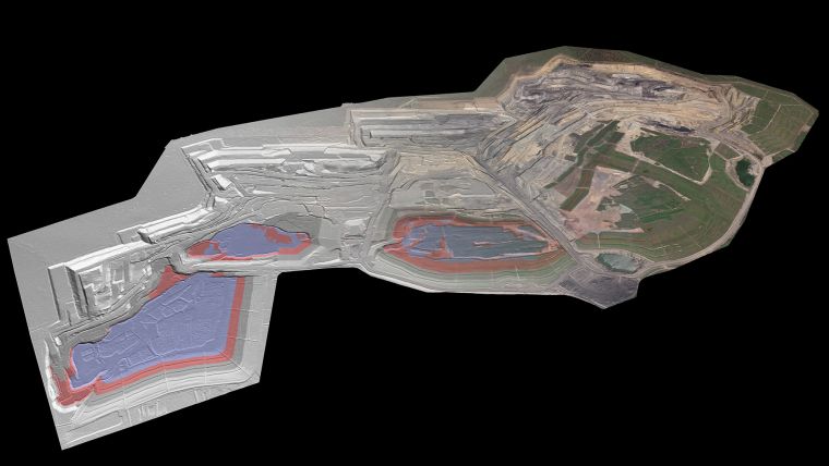
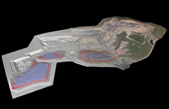
GeoSpatial Manager effortlessly connects users with real-time updates for surveyed surfaces. Its smart visualization tools and user-friendly interface redefine how you interact with as-built surfaces, enabling seamless collaboration and accessibility for all project teams within an organization through a convenient web interface.
The new Mpaptek solution is designed to dynamically update surfaces, allowing users to manage, visualize and download any as-built surface at any given point in time throughout the project lifecycle.
According to Maptek’s global strategy manager, Jason Richards, customers can say goodbye to the challenges of managing vast volumes of survey data. GeoSpatial Manager automatically updates as-built surfaces when new data is imported. Centralized storage on a cloud or network server avoids uncertainty around locating survey files that may be stored in various folders on a local or server machine.
Bridging gap between data and value
“Having the latest data at your fingertips eliminates the risk of using outdated surfaces for critical design work,” Richards said. GeoSpatial Manager allows users to review surfaces for specified dates and times, providing clarity on an operation's current state and key historical stages. “We see improved collaboration and understanding, and GeoSpatial Manager bridges the gap between data and value,” he added.
Customers will be able to send surface data to other Maptek products knowing that GeoSpatial Manager provides a single source of truth for multiple systems. This interoperability harnesses the power of the Maptek ecosystem and streamlines project management. Having all team members working within the same framework enhances communication and workflow. A cost-effective single licence covers unlimited users across the organization, creating flexibility for changes in team size without licence adjustments.

Value staying current with geomatics?
Stay on the map with our expertly curated newsletters.
We provide educational insights, industry updates, and inspiring stories to help you learn, grow, and reach your full potential in your field. Don't miss out - subscribe today and ensure you're always informed, educated, and inspired.
Choose your newsletter(s)


