New UK Building-height Data Released
Customers of OS MasterMap Topography Layer can now access information on the heights of almost 20 million buildings across Great Britain with the alpha release of Ordnance Survey's building height attributes. Released on 17 March, OS MasterMap Topography Layer – Building Height Attributes is a product enhancement to OS MasterMap Topography Layer, and available to licence-holders at no additional cost.
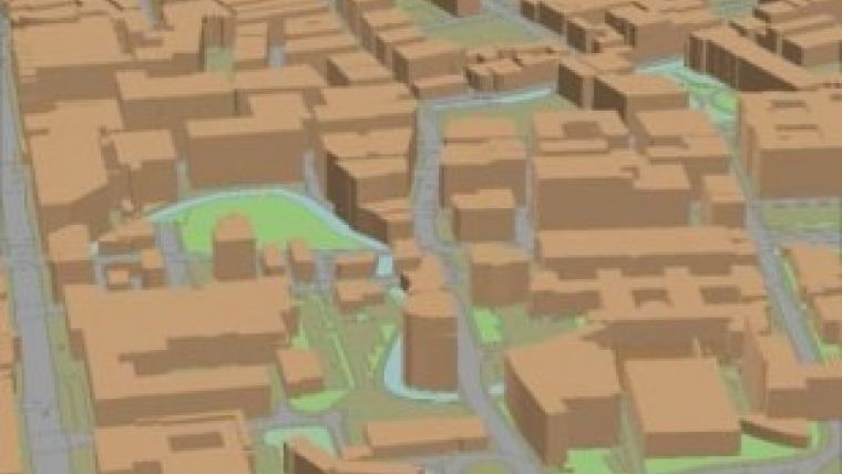
The alpha release covers some 8,000km2 of the major towns and cities across Great Britain, providing customers with additional generalised attributes on building heights. From aiding with planning for ‘right to light’ policies in local government to enabling the utilities sector to plan for telephone or smart meter installation, there are a range of uses for the data. It can be used to make simple 3D visualisations of buildings and assist analytical applications across land and property, energy and infrastructure, public sector and financial services sectors. Future releases will enhance the coverage.
There are an amazing 19,625 million buildings in the towns and cities covered in the alpha release. Added together, the total height of all the buildings OS has calculated heights for comes in at 147,300km – that would take you around the world about three and a half times.
The heights are calculated by a fully automatic process that uses remotely sensed data, including aerial imagery and digital surface and terrain models (the same that are used to produce the OS Terrain 5 and 50 products). Attribution is provided for the ground level, the base of the roof (which can be thought of as being similar to eave height) and the highest part of the roof for each building.
Ordnance Survey is releasing this enhancement as an alpha primarily to get the data to its customers as quickly as possible. However as an early step in the migration to enhanced 3D geometry, this release will also allow the organisation to gather feedback from its OS MasterMap Topography Layer customers to enable future development of the height and 3D strategy.

Value staying current with geomatics?
Stay on the map with our expertly curated newsletters.
We provide educational insights, industry updates, and inspiring stories to help you learn, grow, and reach your full potential in your field. Don't miss out - subscribe today and ensure you're always informed, educated, and inspired.
Choose your newsletter(s)


