NV5 Expands Mobile Mapping Fleet with RIEGL Platform
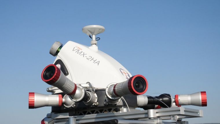
One of North America's leading geospatial data firms, NV5 Geospatial, has acquired a new RIEGL VMX-2HA dual scanner mobile mapping system. The solution will initially deploy in utility and transportation projects and enables them to collect highly accurate, feature-rich data at highway speeds.
The mobile mapping system has been developed to use on various platforms, including boats, all-terrain vehicles, and trains.
“NV5 Geospatial has a long history of working with RIEGL, having utilized their products for aerial platforms as well as earlier generations of the VMX sensors,” said Jonathon Wittman, vice president of acquisition at NV5 Geospatial. “The new VMX-2HA is a powerful solution that enables us to do more detailed surveys, in a form factor that can be set up and ready to go in a matter of minutes. We also appreciate the flexibility of the platform, which enables integration of spherical cameras and other technology that will allow us to explore new, creative survey applications.”
High resolution mobile point clouds
The platform delivers mobile point clouds at a resolution of 1,000 to 4,000 points per square metre (pops) and 0.08' vertical accuracy in terms of 95% confidence intervals. It also features a high-speed 10GigE link, which supports reliable data acquisition of up to two million measurements per second and image data from all integrated cameras.
NV5 Geospatial will launch the VMX-2HA as part of a mapping project for a large US utility company and implement it for work being done for the Department of Transportation.
RIEGL USA mobile division manager, Joshua France stated: “The addition of the VMX-2HA to NV5 Geospatial’s toolbox continues the long-term relationship. Mobile mapping systems and software advancements developed and delivered by RIEGL continue to support greater user productivity. This has been the key to continuing to expand and maintain customers as they see the benefits day in and day out when working in our production environment.”

Value staying current with geomatics?
Stay on the map with our expertly curated newsletters.
We provide educational insights, industry updates, and inspiring stories to help you learn, grow, and reach your full potential in your field. Don't miss out - subscribe today and ensure you're always informed, educated, and inspired.
Choose your newsletter(s)


