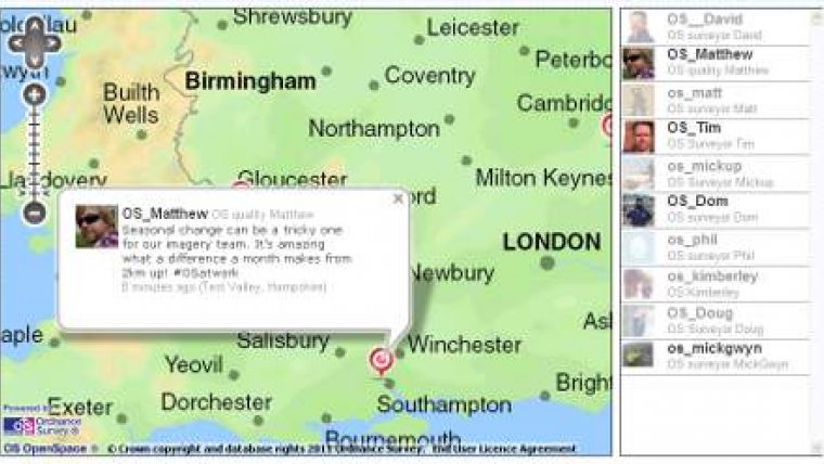
Ordnance Survey Staff Tweeting Their Ways
Ordnance Survey staff across the UK will be using the social networking site Twitter to provide live updates as they map the changing Great British landscape. Anyone interested in maps, geography and the vital role they play underpinning daily life is invited to follow their updates to learn more about the extraordinary range of work they do every day.
Working in a range of roles, from surveyors mapping the outer reaches of Scotland and inner city London, to a member of Ordnance Survey's Flying Unit, each will be tweeting as they go about their work and providing an insight into modern map making.
All Ordnance Survey's new tweeters can be followed as usual by Twitter members, but their location-enabled tweets can also be viewed on a special interactive map built using the mapping agency's web mapping API, OS OpenSpace. The map allows users to easily see where each person is working and gives their location to within a few tens of metres.

Value staying current with geomatics?
Stay on the map with our expertly curated newsletters.
We provide educational insights, industry updates, and inspiring stories to help you learn, grow, and reach your full potential in your field. Don't miss out - subscribe today and ensure you're always informed, educated, and inspired.
Choose your newsletter(s)


