Phase One Launches 280MP Aerial Solution
This article was originally published in Geomatics World.
Phase One has launched the 280MP Aerial Solution, a large-format aerial photogrammetric system, with an image coverage width of more than 20,000 pixels. The new aerial mapping solution is designed to reduce operating costs and produce better returns on investment than today’s traditional large-format systems.
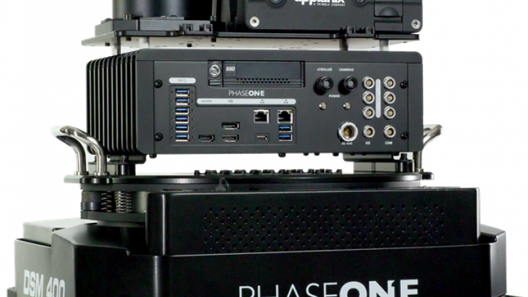
The Phase One 280MP Aerial Solution is a large-format camera system that easily integrates with a DSM400 gyro-stabilized mount, creating a compact and lightweight system for use in a wide range of aircraft. At its heart, the iXM-RS 280F is a dual-lens metric camera, with 90mm lenses for capturing RGB information, providing precision imaging. Adding a near infrared (NIR) camera generates a 4-band configuration, most useful in agriculture & forestry and pipeline monitoring missions.
Central projection image
The iXM-RS280F camera generates a central projection image from two 150MP nadir images with equal ground resolution. The camera’s backside illuminated (BSI) CMOS sensor supports very high dynamic range at 83dB. Its high light sensitivity provides excellent image quality in challenging low light conditions, enabling operators to take advantage of more flight hours per day and more flight days per year.
Dov Kalinski, general manager of Phase One said: “Our 280MP Aerial Solution is a bold and innovative approach to solving customers’ demands for affordable and reliable aerial mapping performance. Previously, opportunities in the aerial mapping business were restricted, due to the high cost of equipment and limited aircraft options. While pioneering superior image quality, Phase One Industrial is creating more profitable possibilities in this exciting and important market.”
The Phase One 280MP Aerial Solution consists of an iXM-RS 280F large format camera, Applanix GNSS/IMU receiver (POS AV series), Somag gyro-stabilized mount (DSM 400), Phase One iX Controller and iX Flight Management software.

Value staying current with geomatics?
Stay on the map with our expertly curated newsletters.
We provide educational insights, industry updates, and inspiring stories to help you learn, grow, and reach your full potential in your field. Don't miss out - subscribe today and ensure you're always informed, educated, and inspired.
Choose your newsletter(s)


