Phase One Launches iX Suite for Seamless Aerial Mapping Workflow
Phase One has announced its new iX Suite, a fully integrated software package for aerial mapping project management. Compatible with all Phase One PAS airborne systems, iX Suite handles mission planning, flight management, data acquisition, image selection and processing and in a common workflow. Phase One is a leading developer of digital imaging technologies.
“We developed the iX Suite for efficient collection and delivery of high-quality aerial image products,” said Oodi Menaker, Phase One iX Suite product manager. “Every step of the workflow is planned and executed to ensure mapping projects are completed on time and on budget.”
Inflight Reviewing and Immediate Re-collection
With the iX Suite, Phase One has taken a novel approach to managing aerial mapping projects by making quality control a key focus throughout the workflow to guarantee the generated image products meet end user specifications. A new aspect of the iX Suite workflow is that imagery can be reviewed inflight and re-collected immediately if necessary, reducing the need for budget- and schedule-killing re-flights several days or weeks later.
Three Aerial Mapping Software Tools
The iX Suite is comprised of three software tools that automate many functions to reduce workloads for pilots and operators in the air and streamline processing activities for technicians on the ground. These three software components are the iX Plan, iX Flight Pro and iX Process.
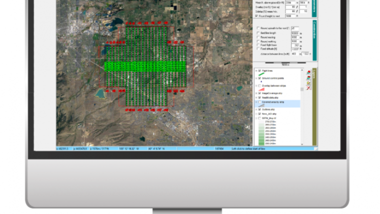
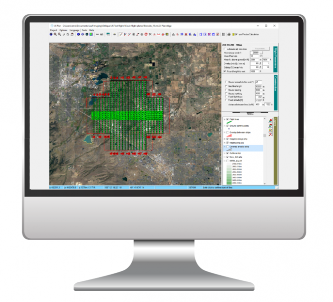
iX Plan is a 3D photogrammetric flight planning application that takes end user requirements, terrain and sensor properties into account to chart flightlines. The software includes a sensor database containing details of all Phase One PAS cameras and Lidar sensors so that each image and point cloud acquisition is planned with exact area coverage, overlap and resolution.
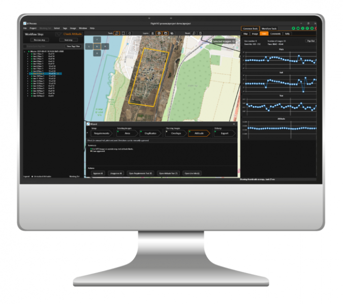
iX Process is an all-in-one mission review, quality assurance and image export application. Using the mission report generated by iX Flight Pro, the processing tool overlays captured images on the flightline map and 3D DTMs, allowing the photogrammetric technician to check again for data quality and precise coverage of geographic areas. Accepted data sets are processed to generate and export images in commercial formats for delivery to end users.
“The iX Suite is tightly coupled with Phase One sensors, making our PAS aerial mapping systems easier, more intuitive, and cost-effective to operate,” said Menaker. “Also, iX Suite interfaces with RIEGL Lidar systems, enabling customers to simultaneously operate a Phase One PAS camera and RIEGL Lidar with one management software in flight.”
A Wide Range of Geospatial Applications
The Phase One PAS line of sensor systems was designed specifically to address the challenges of aerial image acquisition for 2D and 3D city modelling, photogrammetric mapping and surveying, agriculture and other geospatial applications. The PAS product line includes the five-camera PAS 880 oblique and nadir system, PAS 280 large-format system and PAS 150 systems.

Value staying current with geomatics?
Stay on the map with our expertly curated newsletters.
We provide educational insights, industry updates, and inspiring stories to help you learn, grow, and reach your full potential in your field. Don't miss out - subscribe today and ensure you're always informed, educated, and inspired.
Choose your newsletter(s)


