PlanetObserver Launches New 10m Global Imagery Basemap
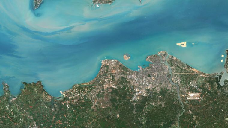
PlanetObserver has released PlanetSAT Global 2022, a basemap that provides ready-to-perform, cloudless and homogeneous imagery. With outstanding 10m resolution, PlanetSAT Global imagery basemap provides access to detailed geographic information from global scales all the way down to 1:50,000 map scale.
One major feature of PlanetSAT basemap is the updates that PlatetObserver releases on an annual basis. The company states that outdated imagery is often of little or no use for many projects and solutions. Annual updates ensure that users can access the most current image layer available.
For PlanetSAT Global 2022, more than 10 million km² of fresh 10m imagery have been ingested in the global basemap. The main updated areas include the USA and the United Arab Emirates. In addition, over 170 major cities worldwide have been updated.
The refreshed imagery content continues to grow. PlanetObserver has committed to an impressive annual update schedule. This makes this global imagery solution more robust every year, having analysed and processed more than 204.4 trillion pixels of data since 2003.
Cloudless imagery
Selecting the proper satellite imagery to create a mosaic is very challenging. More than 70% of Earth is constantly covered with clouds throughout the year. Consequently, PlanetObserver takes advantage of the different seasons to get the best possible cloudless imagery for each area.
Recently, satellite imagery providers have released “completely cloudless” basemaps. However, this is not achievable for tropical areas in South-East Asia, Africa and South America that are covered by clouds 99% of the time. One common approach is to change the colors of cloudy areas for the map to look homogeneous even though the real geographic data is not accessible. However, this damages the data and gives the user a false overview of the desired area.
PlanetObserver’s strategy is to remove clouds from the basemap at each annual update by selecting 100% cloud-free source imagery. However, for all tropical areas, they keep the real pixels, even though clouds might still be present. The company’s commitment is to provide real and reliable geographic information.
Free-to-use viewer
For the first time, PlanetObserver is integrating a free-to-use viewer. Previously, only clients could access the basemap. This year, the company has decided to make their data more visible to the world and give everyone a taste of how satellite imagery is supposed to look like.

Value staying current with geomatics?
Stay on the map with our expertly curated newsletters.
We provide educational insights, industry updates, and inspiring stories to help you learn, grow, and reach your full potential in your field. Don't miss out - subscribe today and ensure you're always informed, educated, and inspired.
Choose your newsletter(s)


