Pointfuse V3 Point Cloud Software Announced
Arithmetica, the company behind Pointfuse point cloud conversion software, has announced it will be releasing Pointfuse V3 on 18 September 2017. Offering a new approach to the processing of point cloud data, Pointfuse V3 produces 3D models that are a quarter of the size of the original point cloud and streamlines the workflow of the engineering and design professional user.
The automatic data conversion process in Pointfuse V3 aims to reduce the cost of projects undertaken by anyone using a 3D reality capture system to supply data for use in 3rd party architecture or engineering design solutions.
Object classification
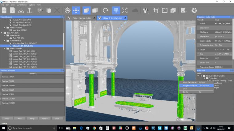
Pointfuse V3 builds on the advances already seen in Pointfuse V2, which was launched amidst much acclaim in 2016. Offering ‘selectable surfaces’, Pointfuse V3 provides an innovative approach, classifying objects within a 3D scene. Surfaces within the 3D models produced by Pointfuse V3 can now be identified, grouped and classified. These characteristics bring workflow efficiencies to the project that are not possible when working with point clouds or traditional mesh models.
The technical advances promised in Pointfuse V3 are also supported with some changes to the user interface and data processing algorithms, making the software faster – with point clouds converted to high fidelity models in a matter of minutes, and simpler – with one parameter, one button processing. Using Pointfuse V3 reduces a firm’s billable project hours and increases the return on investment in 3D laser scanning of photogrammetric capture solutions.
Vector models
Arithmetica has been working on Pointfuse V3 for some time, and the feedback from user testing is that the new functionality and features on offer are eagerly awaited, with some projects even being put on hold until it becomes available in the next few weeks, commented Mark Senior, business development manager at Arithmetica.
Pointfuse is a powerful modelling engine that delivers a fast, precise and flexible way of converting the vast point cloud datasets generated by laser scanners or photogrammetry into high fidelity vector models. Designed for anyone capturing or using point cloud data, Pointfuse uses advanced statistical techniques to create vector models which can then be manipulated using any industry-standard CAD system.
For more information visit the Pointfuse product page at Geo-matching.com

Value staying current with geomatics?
Stay on the map with our expertly curated newsletters.
We provide educational insights, industry updates, and inspiring stories to help you learn, grow, and reach your full potential in your field. Don't miss out - subscribe today and ensure you're always informed, educated, and inspired.
Choose your newsletter(s)


