RapidEye Satellite Image
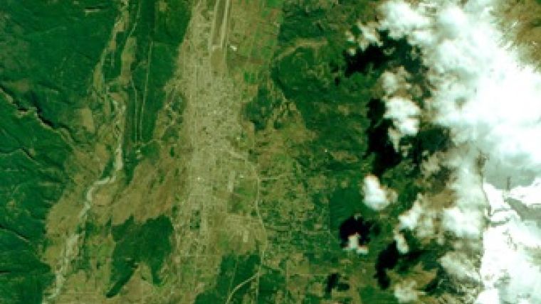
The first public release of a RapidEye image has been unveiled. This demonstration image highlights the capabilities of RapidEye imagery in many market segments, by showing diverse landscapes that include agricultural fields, forests, cities and roads.
The image shows the area of El Bolsón in Argentina near the Argentinian-Chilean border. El Bolsón is situated in the far southwest of the Río Negro Province in Argentina at the foot of the Piltriquitron Mountain. The image was recorded by RapidEye's camera built by Jena-Optronik of Jena, Germany from the satellite RapidEye # 1, named Choros, at a nadir view angle and has a pixel size of 5 meters. It was downloaded to KSAT (Kongsberg Satellite Services) in Svalbard, Norway and electronically transmitted to the RapidEye headquarters in Brandenburg, Germany.
The commissioning and calibration phase that the RapidEye system is currently undergoing is expected to last into December, allowing for commercial operations to start by the end of this year. At that time RapidEye plans to have radiometrically corrected and orthorectified demonstration datasets available for download on the company website. They will include all accompanying metadata files.
Caption: The area of El Bolsón in Argentina, acquired from the satellite RapidEye # 1, named Choros.

Value staying current with geomatics?
Stay on the map with our expertly curated newsletters.
We provide educational insights, industry updates, and inspiring stories to help you learn, grow, and reach your full potential in your field. Don't miss out - subscribe today and ensure you're always informed, educated, and inspired.
Choose your newsletter(s)


